As we move into a second month of local quarantine and social distancing both at work and at home, a small grace has been the ability to get out to some of the parks (which have remained open, by and large here) to get regular fresh air, some exercise, and to keep from getting too stir crazy! Here are a collection of mostly unedited photos over the past several weeks.
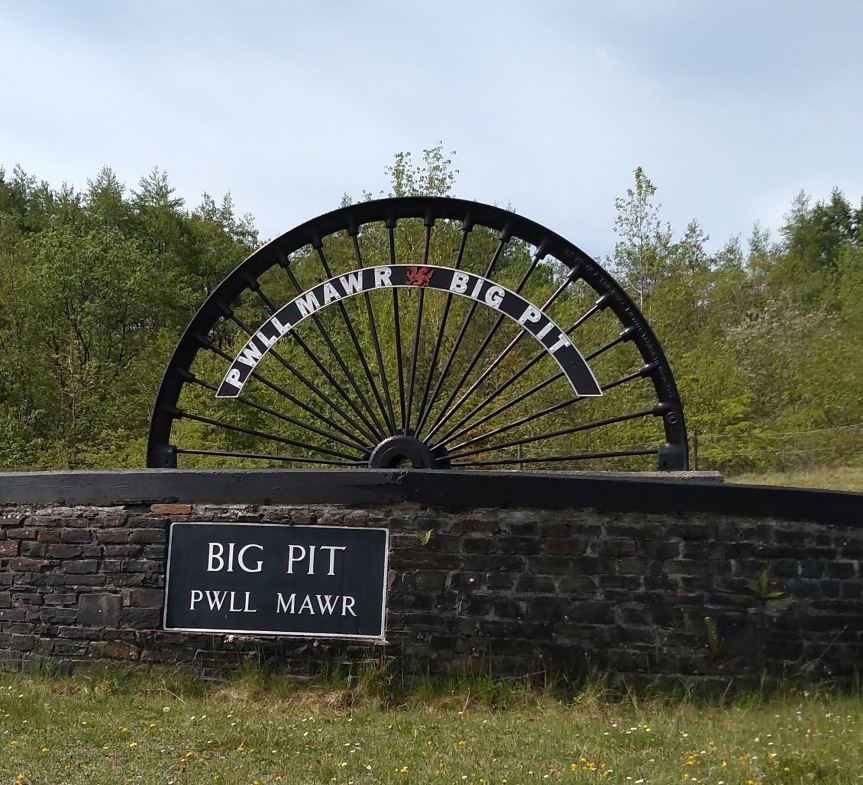
Our final “big day” on our UK trip was back to Wales and a tour of the Big Pit National Coal Mine in Blaenavon (that’s near Pontypool, if that helps?) [map]. Last active in 1980 after 100 years of operation, the mine is now run as a museum and national heritage site. Most of the tour guides are former miners who, along with their first-person accounts and in-depth knowledge of mining history, have become perfect ambassadors for their contributions to history.
What is a mine, after all?
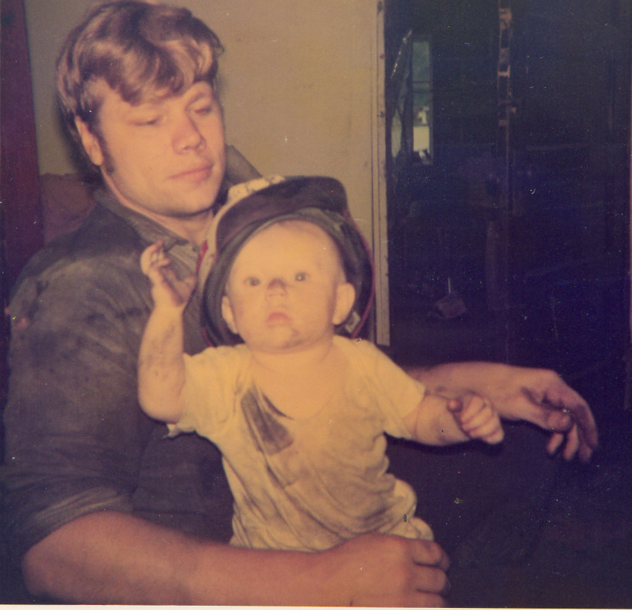
Mrs. Lonely Birder’s family comes from a strong tradition of mining and related work in the coal regions of Appalachia. Generations of her family have worked the mines and even lived in mining camps and towns. These people are hard working and proud. There can be no denying coal’s importance to the development and transformation of modern life around the world. As we struggle to adapt to new power sources and new understandings of the environment, it’s all too easy to lump in the miners and the equipment operators and the truck drivers with the “coal industry” and bad mouth the whole lot. Fossil fuels are indeed responsible for as much negative transformation of the environment as they have been necessary for the advancement of modern technology. Even as that trade-off has become unbalanced and we recognize the need to move away from coal and other fossil fuels, we should not forget the debt we owe to the miners and their families for providing the power to live our relatively comfortable lives.
My father-in-law with his Coal Miner’s Daughter, in the early 1970s, West Virginia.
It was eye-opening to delve into the mine and see the conditions and equipment used through the 100 years of mining on-site. Some of the scenes depicted in the display spaces and videos would be instantly as recognizable to someone from West Virginia as Wales.
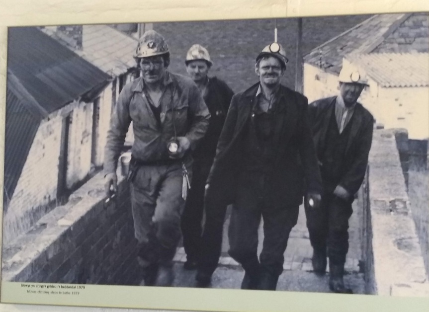
Photo display of Big Pit miners after their shift.
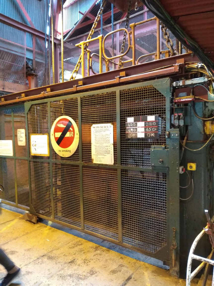
They did not allow any photos to be taken inside the mine. We rode the same cage (the large elevator) as the miners did when the mine was operational, and observed the same safety rules. Nothing was allowed down the mine that could generate any kind of spark. There was always the danger of natural gas or coal dust exploding, more then than now. But it’s better to be safe than sorry.
This cage (as the miners called the elvator), crammed with miners, was the only way in or out of the mine.
We saw some areas that were restored to a turn of the 20th Century set-up, with pit pony stalls and equipment. These ponies might not see the light of day for their whole lives once in the mine. That finally changed when mining safety and health regulations were changed and they were allowed on occasion to have a break and more humane treatment by the early 1900s. Human health and safety regulations were also updated. Child labor was common throughout the 18th and 19th Century coal mines, but eventually was legislated out.
A few more displays showed the working mine through the 20th Century, leading up to it’s eventual closure in 1980. By then, the mine was not profitable enough to keep open.
Intermission: Roast Ox Crisps
After our mine tour, I had one bit of unfinished business that I was finally able to complete on this trip.
Years ago my life was changed when my big brother and I stumbled onto the local PBS channel showing this amazingly violent (at least for its time) and hilarious comedy from the UK called The Young Ones. Think “The Three Stooges” meets “Monty Python’s Flying Circus,” and you’re most of the way there.
Neil (Nigel Planer), Rick (Rik Mayall), Mike (Christopher Ryan), and Vyvyan (Adrian Edmonson) – The Young Ones. Rik Mayall passed on a few years ago. R.I.P. (P)Rick!
The show ran for 2 series in the early 1980s, and was important for introducing me to the band Motorhead during one of the show’s at-times random musical intermissions.
The late Lemmy Kilminster with his classic shades and trademark mustache. Built for speed until the end.
One episode has the boys head to the local pub, where Madness is just finishing up a set. Vyvyan is about to go order their food at the bar, and Neil asks for something vegetarian so Vyvyan promptly orders a bag of roast ox crisps.
Imagine as a preteen in 1980s suburban America, where at the time the most exotic crisp (potato chip) was probably either salt and vinegar or if you lived near Canada, ketchup. Roast ox chips sounded so preposterous and amazing!
Fast forward to The Big Pit mine visitor’s cafeteria in 2019. I’d mentioned roast ox crisps during our trip and had been told by our friends that THEY DO EXIST! It took some time and hunting, but finally we found some in the snack bins. They were every bit as amazing and terrible as I had hoped!
“Oh, just a bag of crisps please, Vyv. But, not meat flavored. Because I don’t abuse my body and the world I live in.”
My friends and followers in the UK are probably wondering what the fuss is about. After all, there is a dizzying array of crisp flavors available there (like prawn cocktail and Worcestershire sauce). Only now is the US getting caught up, though the specific flavors differ (grilled cheese and tomato soup and roast chicken are fairly new here).
And We’re Back
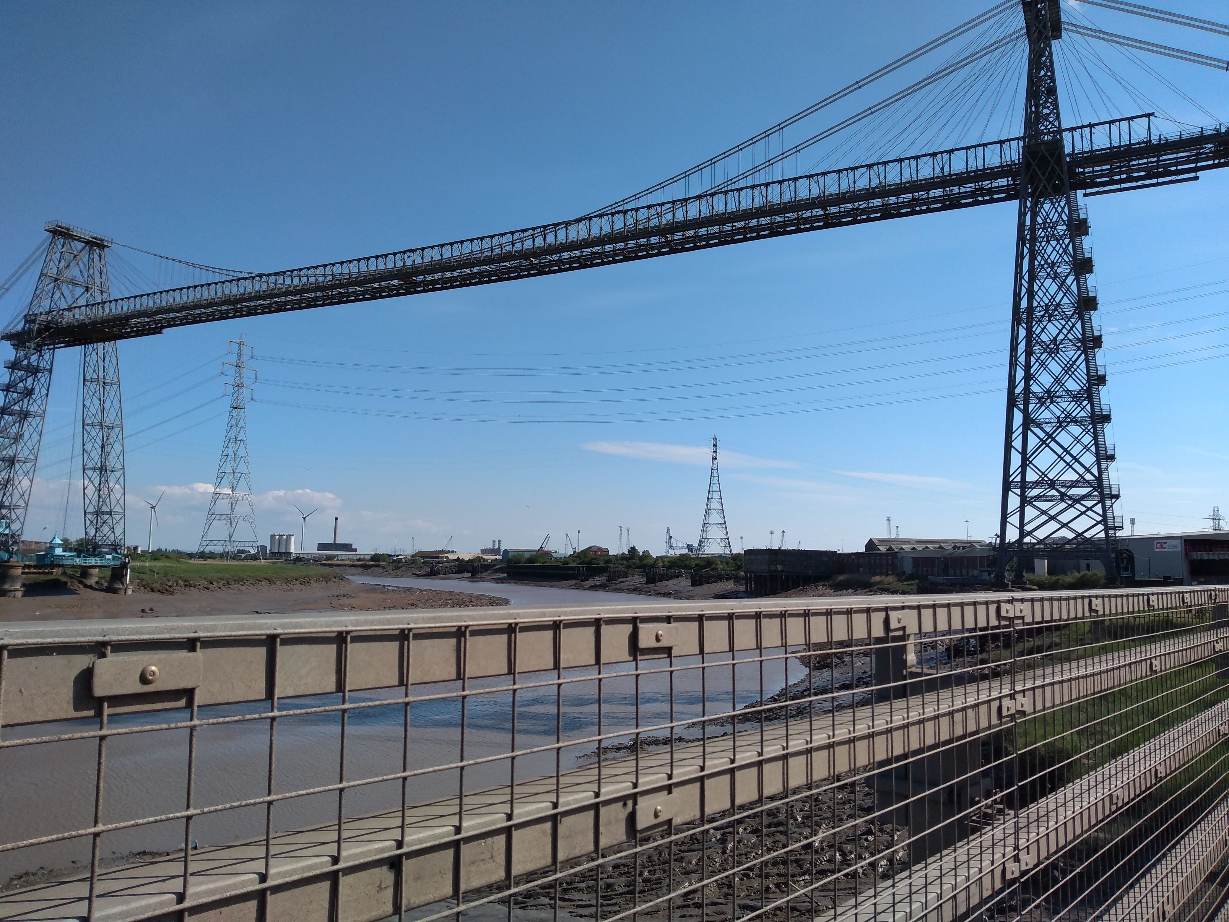
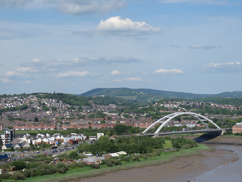
After leaving the mine, we stopped in Newport on our way back to Bristol to check out the Newport Transporter Bridge [map]. This engineering marvel was built in 1906 as a means of crossing the River Usk, which had some specific challenges. The banks are low, but the span quite wide. A bridge needed to span the distance while allowing for ships to pass, and a drawbridge would be impractical. The solution was to erect two tall towers on either side and have a transport car, hung from above, operated by cables. This way, the transport car would be safely on the banks of the river while a ship passed.
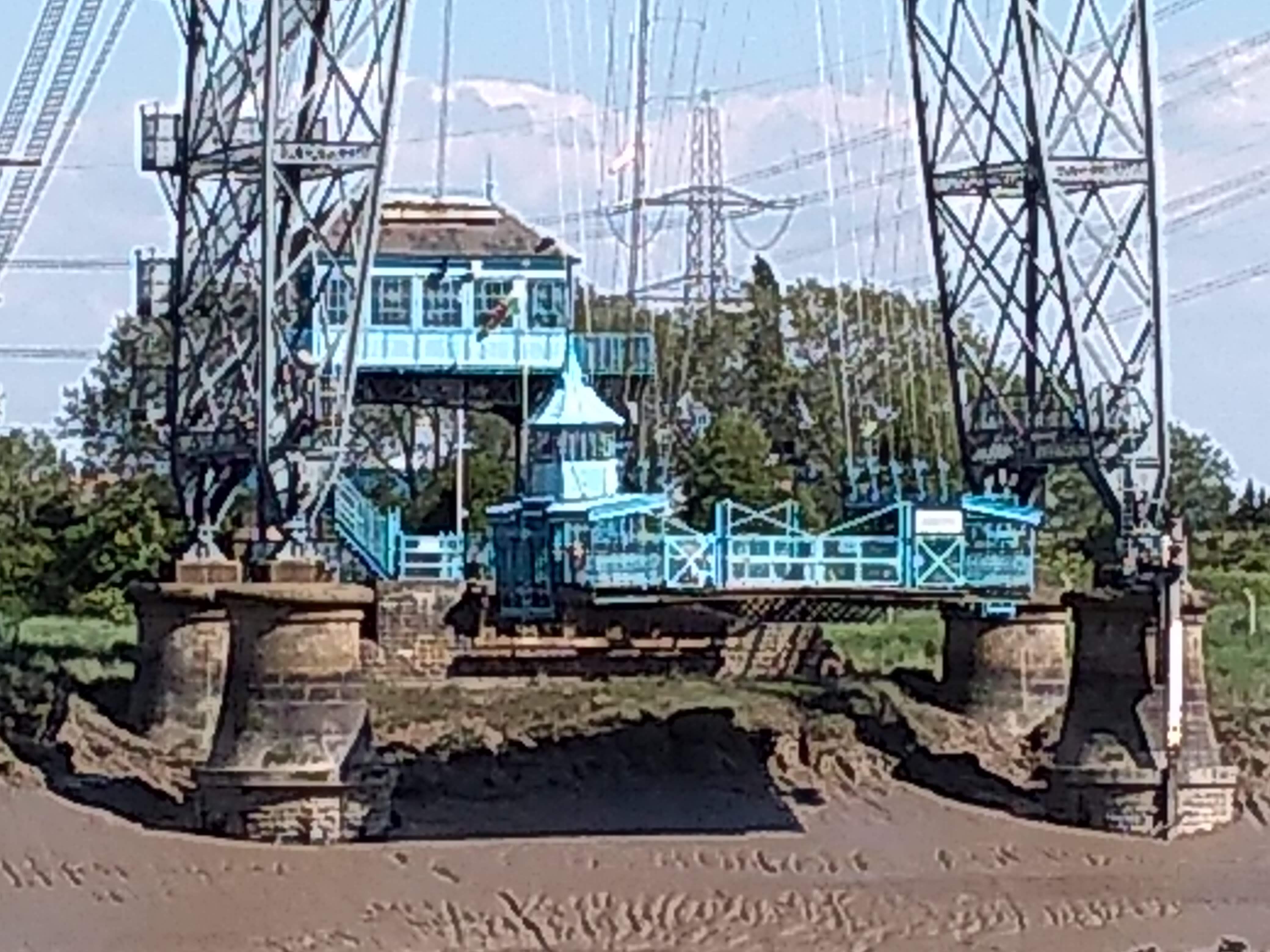
A view of the transporter bridge. The gondola is the light teal object near the bottom of the tower on the left.Close up of the gondola, on the far bank.
On the day we went, the gondola was closed for maintenance, unfortunately. But the towers and catwalk above were open. It’s over 60 meters (nearly 200 feet) to the catwalk, up an unrelenting set of stairs. Having spent most of the last 17 years in Florida, you can imagine this was no small task (in fact, it was a crash course in relearning hills and stairs for two weeks, since we arrived).
A view of the river and surroundings from part way up the stairs.
The bridge is open to visitors and tourists until late afternoon, so we had to hurry up and across and back without much time to rest or take in views. Mrs. Lonely Birder opted not to make the climb, so the remaining three of us clambered up.
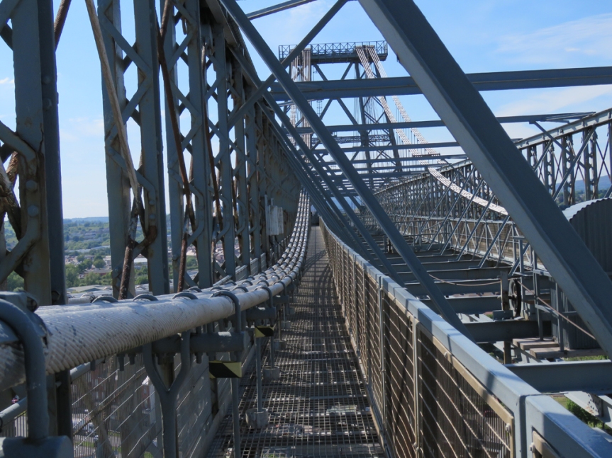
These catwalks were designed for maintenance, and allow access to the suspension cables and upper superstructure.
I thought the bridge looked very well maintained for something over a century old.
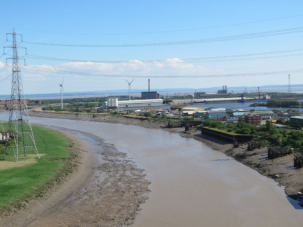
The views we did get from the catwalk were spectacular, and the weather was particularly nice. The River Usk is a tidal river here, and you can see the tide was out, exposing a lot of mud near the river banks.
A river view and City Bridge, in Newport.Newport and the Welsh countryside beyond.
We managed to get back down to the visitor center in plenty of time, and had a nice chat with the person there before heading back to Bristol and getting ready for another evening and then another day. I think Wales is rather pretty, and if we get a chance to go back to the UK, I wouldn’t mind seeing more of it than we had time for. Diolch a ffarwel, Cymru!
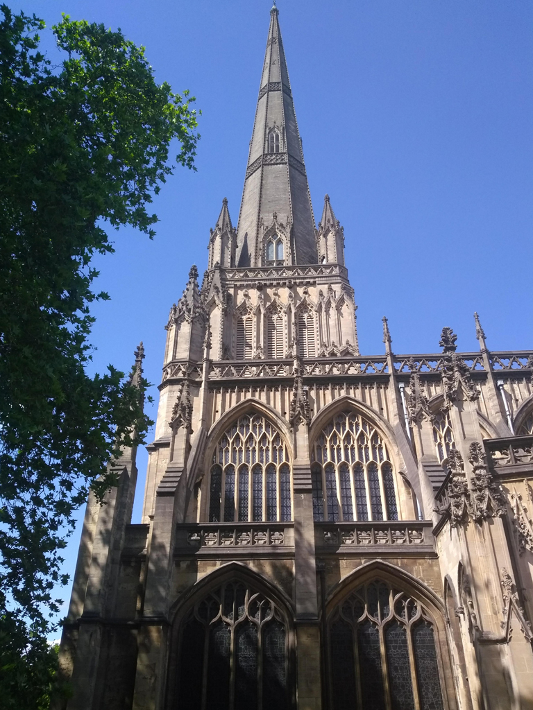
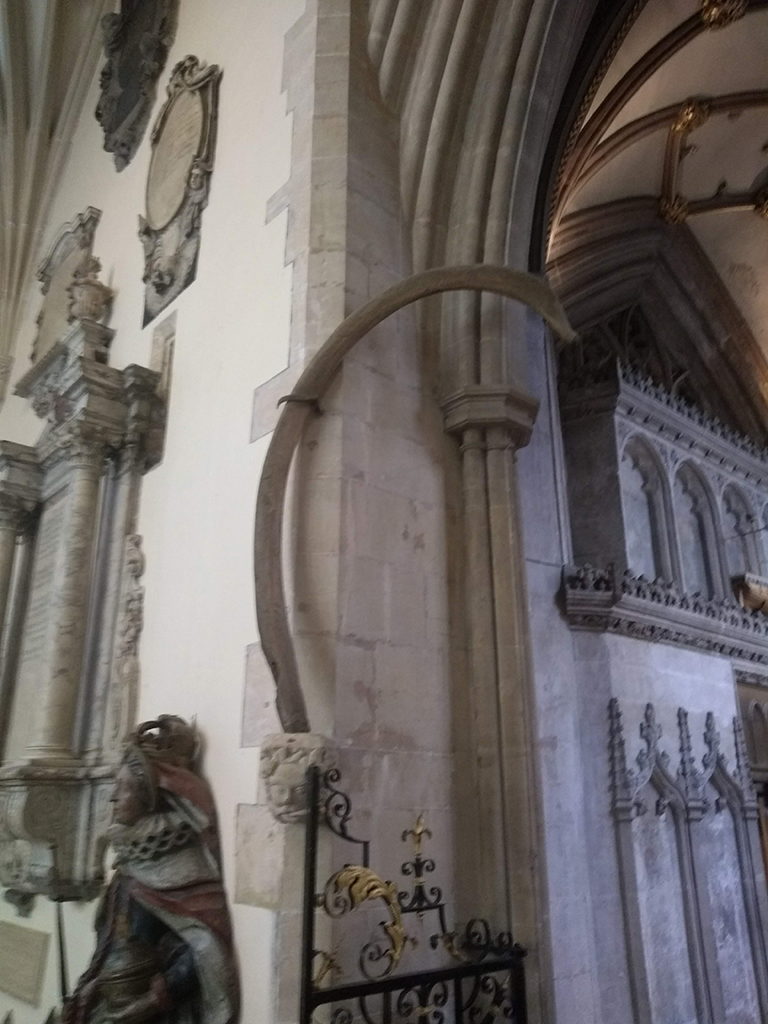
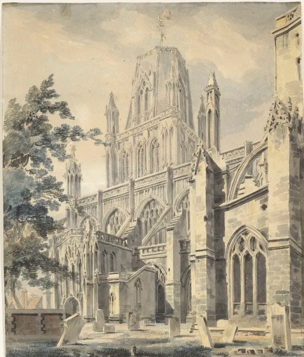
After almost two weeks of intense riding around England and Wales (Darren and Ruth doing all the driving, bless their souls), we took a slightly slower day and focused on Bristol itself. We did have a lovely visit to the Bristol Museum [map], which is probably one of the better local museums, but decided to leave the picture taking behind. But the centerpiece was the church of St. Mary Redcliffe [map].
St. Mary Redcliffe is situated right inside urban Bristol, so there aren’t many clear overviews of it. This view is looking east.
This church building has been called the epitome of high English Gothic architecture, and it isn’t hard to see why. The ornate stonework and tracery, as well as the flying buttresses and the tall spire, mark this – one of the largest parish churches in England – a real stand-out. Queen Elizabeth I is said to have described it as “the fairest, goodliest, and most famous parish church in England.”
Part of the northern facade of the church. The tower and spire are just off to the right.
Inside, the church as a couple items of historical note. There’s a model of John Cabot’s ship, The Matthew, to commemorate his 1497 voyage to North America, as well as a piece of whalebone he brought back to England. We had visited the observation tower named for Cabot on our first day in Bristol. Cabot’s expeditions sailed from Bristol under the commission of King Henry VII.
Whalebone from North America, via John Cabot’s expeditions in the 1490s.
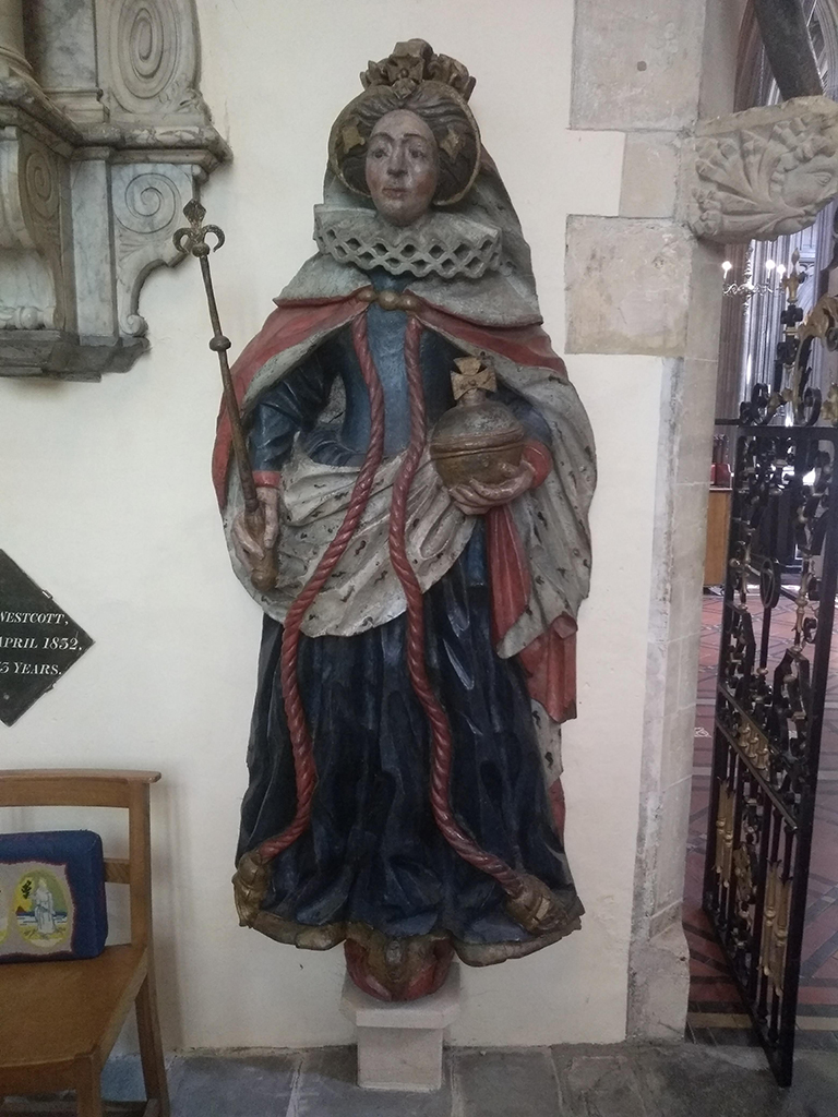
There is also a wooden carving of Queen Elizabeth I, dating from her reign (likely circa 1570). She is known to have visited the church in 1574, but I don’t know if the carving was already there, or done later to commemorate her visit. It is remarkably well preserved, though I suspect the paint’s been touched up now and then.
HRH’s likeness in painted wood.
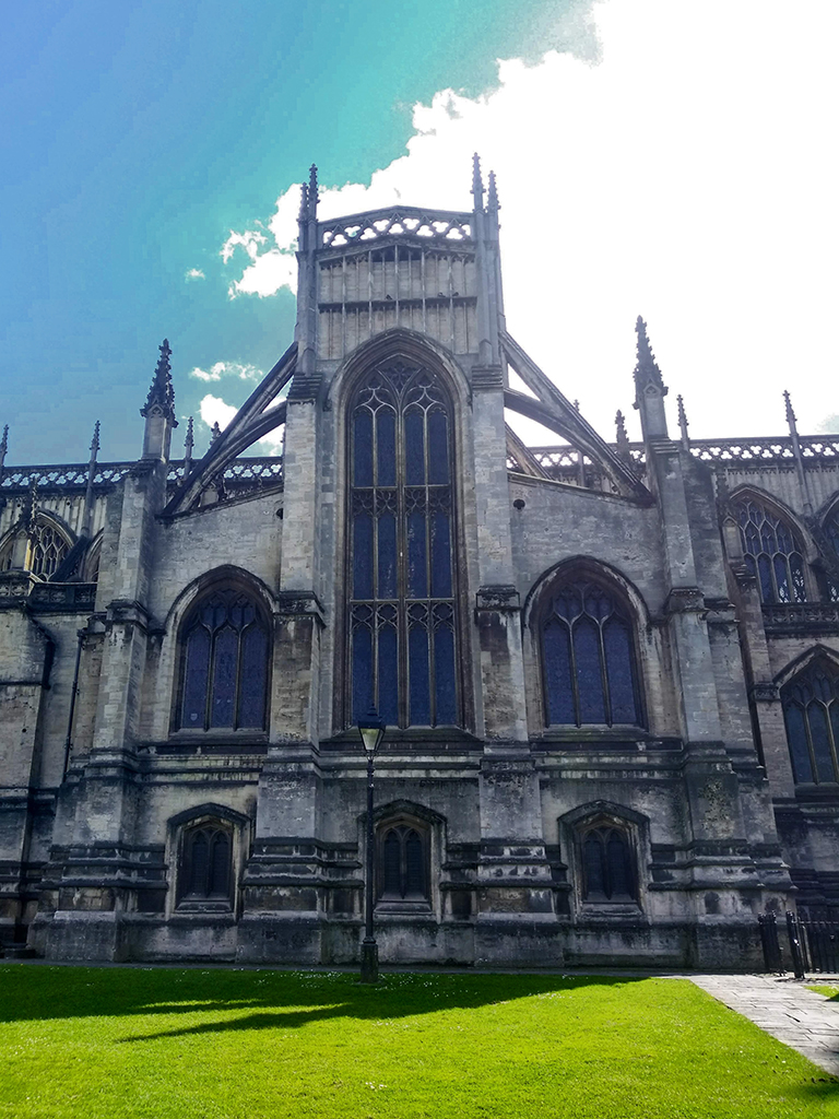
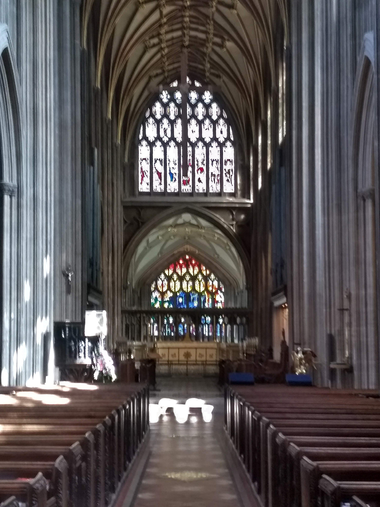
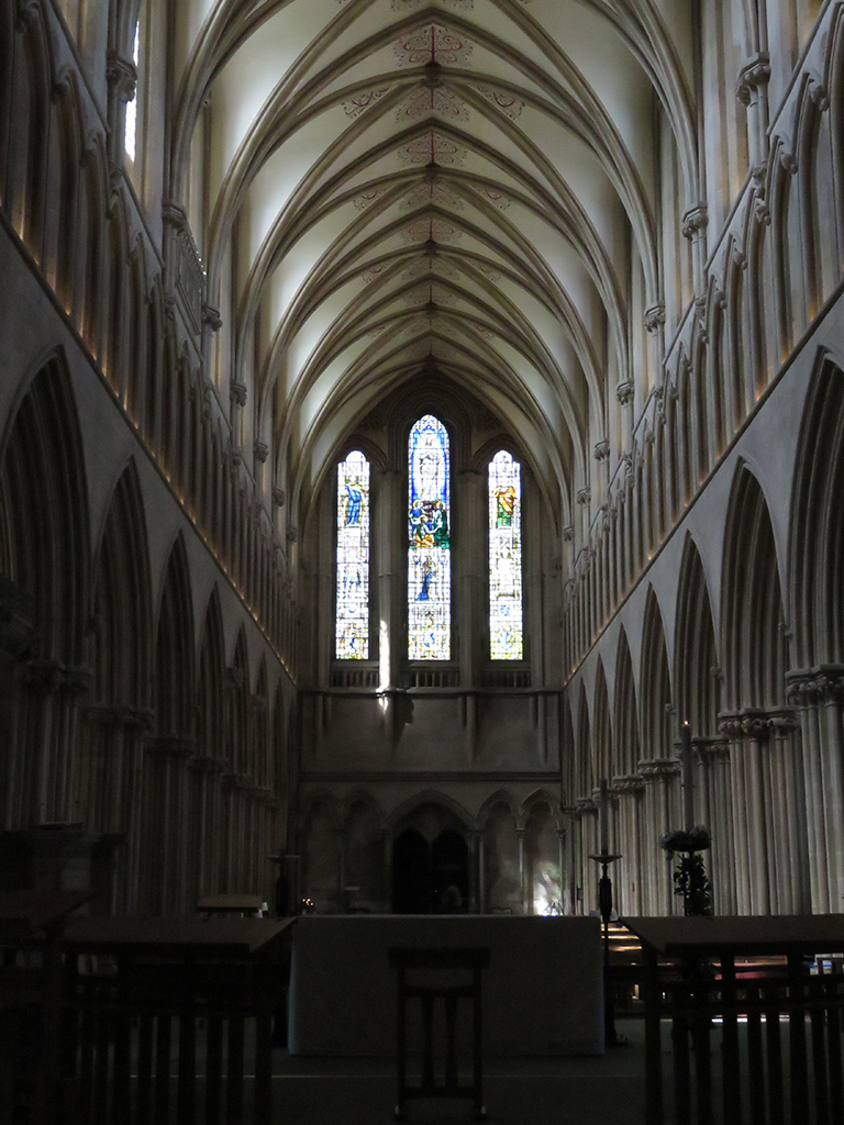
The rest of the interior is quintessentially Gothic, with high, almost delicate looking arches and vaulting and exquisite stained glass. Much of the original stained glass was destroyed during the Reformation, but later replaced. Bombing in the second world war destroyed the glass on the west side, and was replaced again.
A view along the nave toward the restored stained glass on the west side of the church.
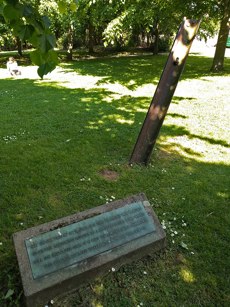
That bombing could have destroyed the church, and a poignant reminder of that is a section of tramline (from a light rail system) that was blown up and onto the church grounds, where it remains today as a memorial and reminder.
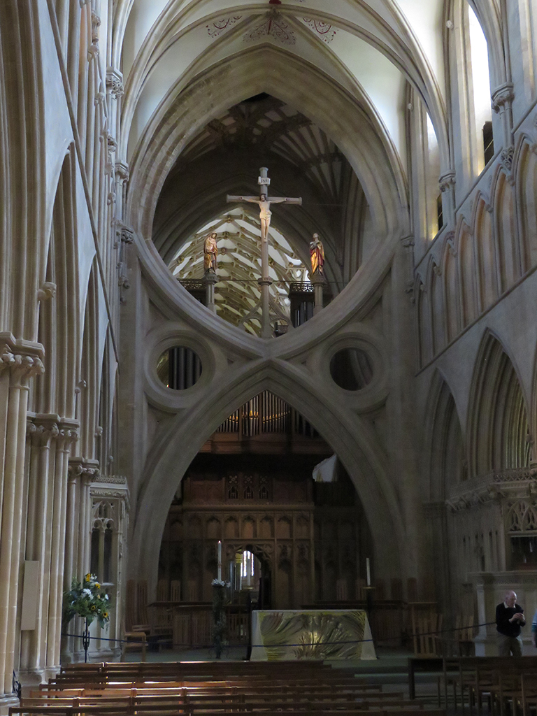
This section of rail was left embedded where it landed after a German bombing in 1941. On Good Friday, to be exact. [Thanks, Mrs. Lonely Birder for the photo!]St. Mary Redcliffe’s interior is stunningly beautiful and, like most Gothic churches, airy and open. It’s tempting when we hear “Gothic” and architecture of the Middle Ages (“The Dark Ages”) to think of heavy, dark, and oppressive themes. But on the whole, this church and the other medieval structures we saw during our visit, were more atmospheric and almost ethereal. The designers were building these spaces to evoke heaven and salvation, and that’s very much reflected in this church.
Another interior view of St. Mary Redcliffe. The ceiling decorations are more golden than what shows up in this photograph, but really, no photos truly do justice to this amazing place.
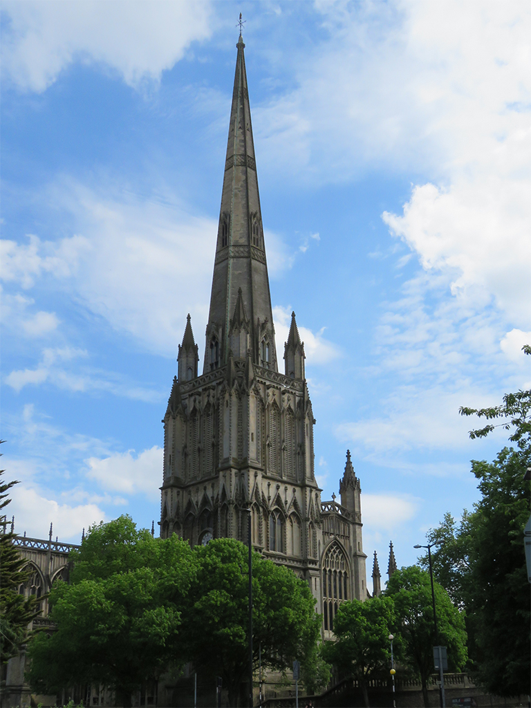
As a final note to this spectacular church, the tall spire you can see today was finished in 1872. The original was destroyed in a storm – perhaps struck by lightning – in the 15th Century. For much of it’s existence, the church had short, truncated cone cap on its tower.
This watercolor by J. M. W. Turner shows St. Mary Redcliffe with its truncated spire. It would be almost 80 years before the current spire would be built. Image copyright Bristol Culture.
One final look at St. Mary Redcliffe and its spire.
We also visited the M Shed museum, though we took no photographs as some areas expressly forbade it, and we were so engrossed that we didn’t think of it! There were some interesting Banksy pieces and some great tributes to Bristolians and their city. If you visit Bristol, M Shed is a must-see!
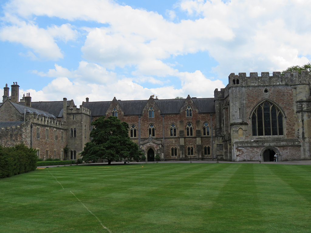
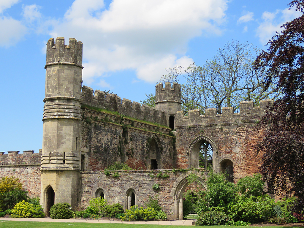
We had a good look at Wells Cathedral in Part 1, so let’s continue on to The Bishop’s Palace.
May 20, 2019
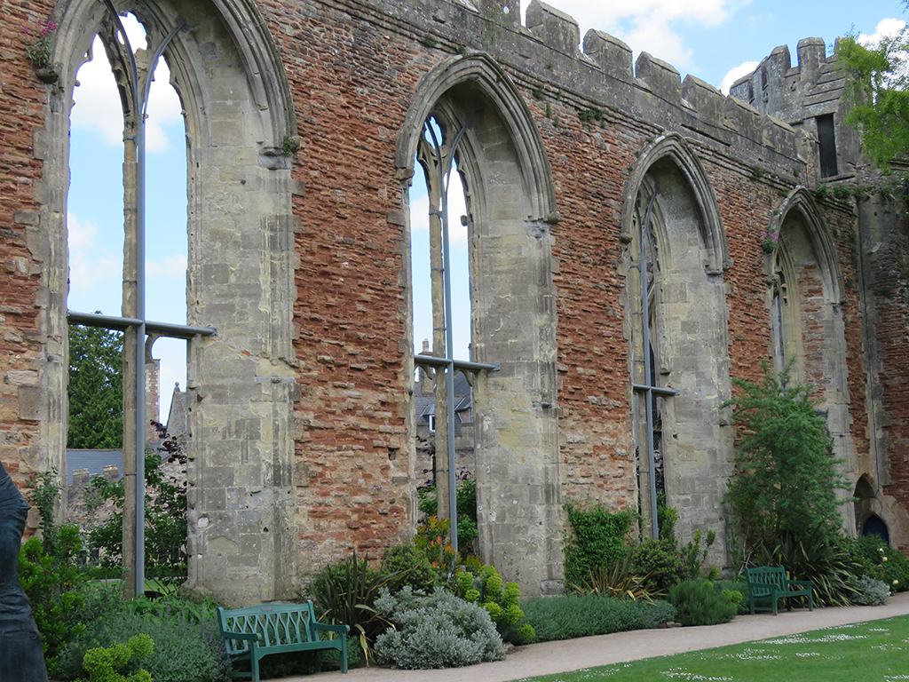
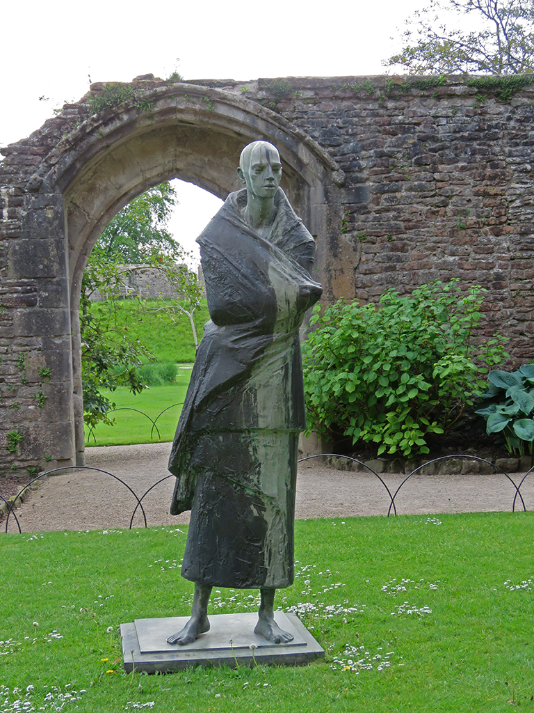
The palace has been extensively modified and added to over the course of 800 years, and is reflective of many architectural styles.Some parts of the palace are ruins or have been adapted, like this wall which now forms part of the enclosure for a large lawn space.
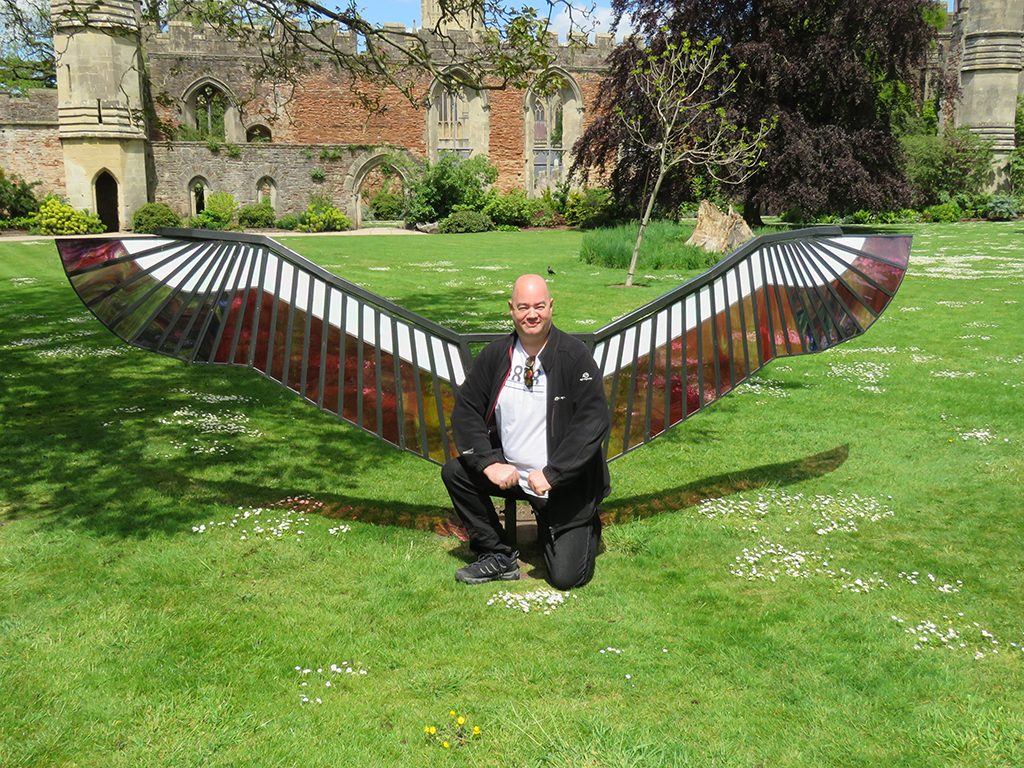
The grounds were fairly extensive, with opportunities to see many stages of development and abandonment. They also serve as space for art – both secular and religious – and even political expression.
There were nice art installations – some religious, some secular – throughout the grounds.Stained glass wing sculpture (there were a couple of them).MCU Falcon character reboot?
Many of the ruins on the palace grounds are at least somewhat intentional. As parts fell into disrepair, the structures were modified to be “more picturesque” as successive bishops and architects sought to mold the expansive ruin to their own ideals.
The formal gardens and landscaping are indeed beautiful, and the views of the Cathedral itself are as worthy as any artistic masterpiece, in my opinion.
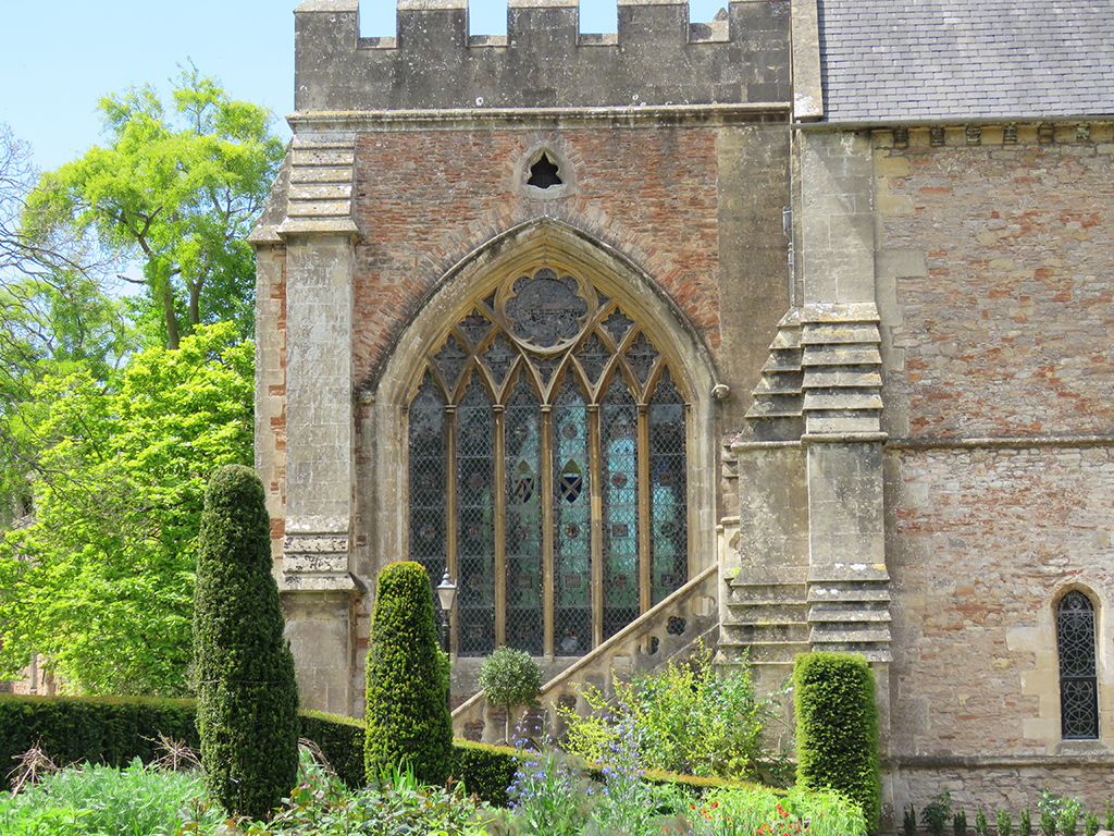
Looking in on the Bishop’s ChapelSprings and gardens on the palace grounds.As optimally designed, this church would have a tall spire atop the central tower. Weather and fire have made all but a few lost over time.Another magnificent view of the cathedral from the formal gardens.
Similar to the city of Bath, Wells gets its name from the abundance of accessible groundwater and natural springs, many of which were harnessed or enhanced on the palace grounds.
The small waterfall drops water down into a system of channels.Another formal water feature based on the natural upwellings.
The interior of the palace, including the chapel, is a progression and mixing of the various historical periods, spanning from the 13th century to modern day. In the essence of saving time, here’s a slide show of the interior shots.
This slideshow requires JavaScript.
Some interior shots of the Bishop’s Palace. Most of it is a museum and public space now, but the nearby Bishop’s House is still used as a residence and church office.
Both the church and the palace were immense and impressive, and it’s hard to portray the grandeur from these photos. With any impressive space, be it natural or human, it’s best to experience it in person. Hopefully that’s something that you can do one day, if it is in your means.
Farewell, Wells!
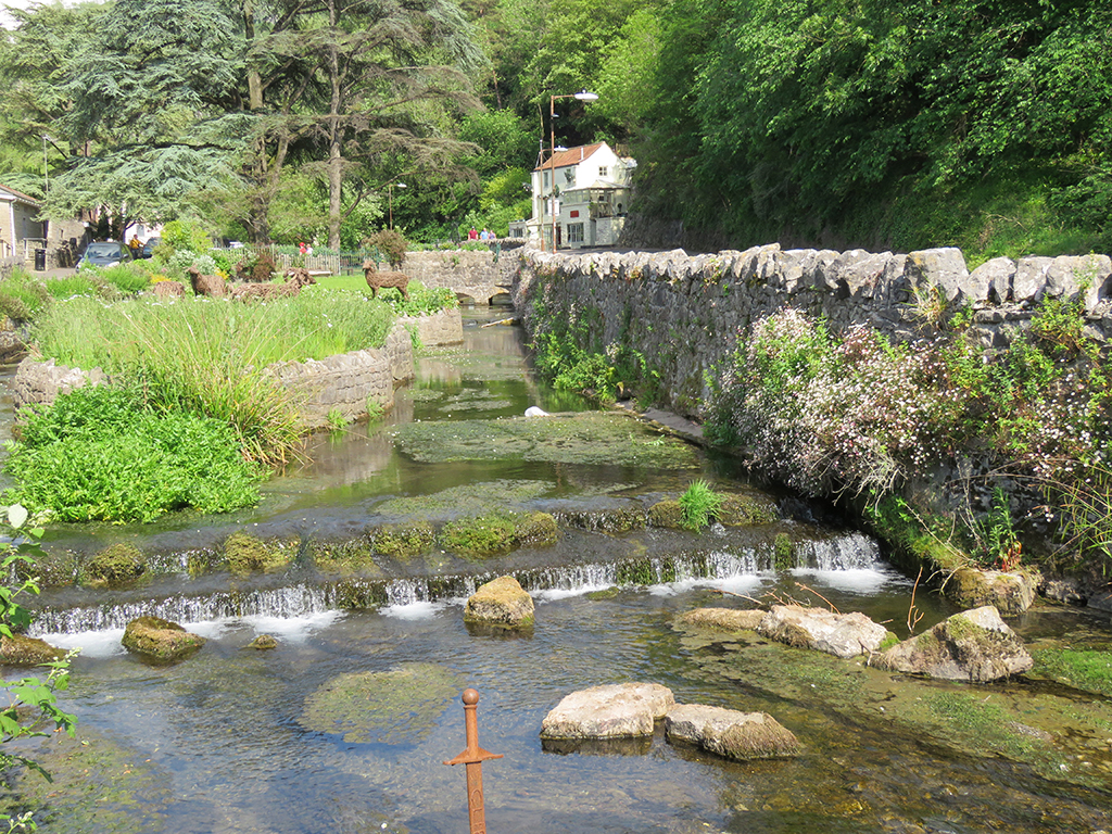
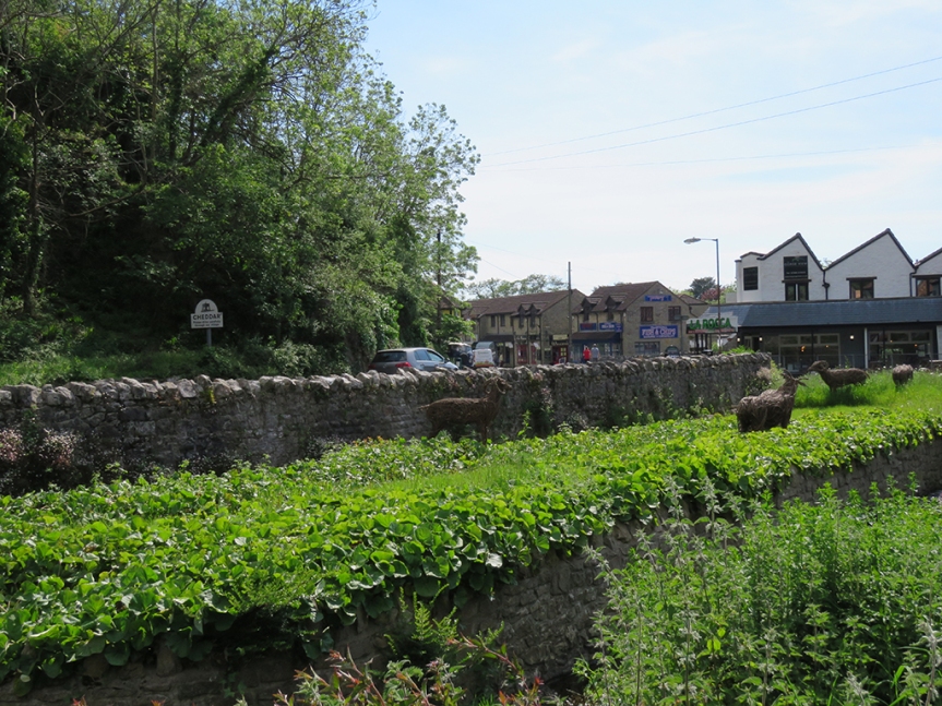
But our day was not over yet. We had some time to make an almost too-quick run to Cheddar, where we did buy and eat some “genuine” Cheddar Cheese, and make a brief drive up the gorge. Cheddar is a quaint village, and if we ever do return to the UK, I’d like to spend a little more time there.
The village has many quaint shops and picturesque views.
The waters that carved the gorge and associated caves is the Cheddar Yeo, and it emerges above ground in the village. It’s been a traditional source of power for centuries.
The Cheddar Yeo, emerging in the village of Cheddar. Part of an “Excalibur” sword, for tourists has surely rusted in place by now.A pretty view of the village and the animal sculptures in the channelized water feature.
We did some window shopping and I bought some local fudge before we headed back to Bristol for the evening, having had another full and satisfying day out with friends.
Welcome back, my friends! Let’s get back on track with my adventures earlier this year in the United Kingdom. This update is longer than most, So I’ve broken it up in two.
May 20, 2019
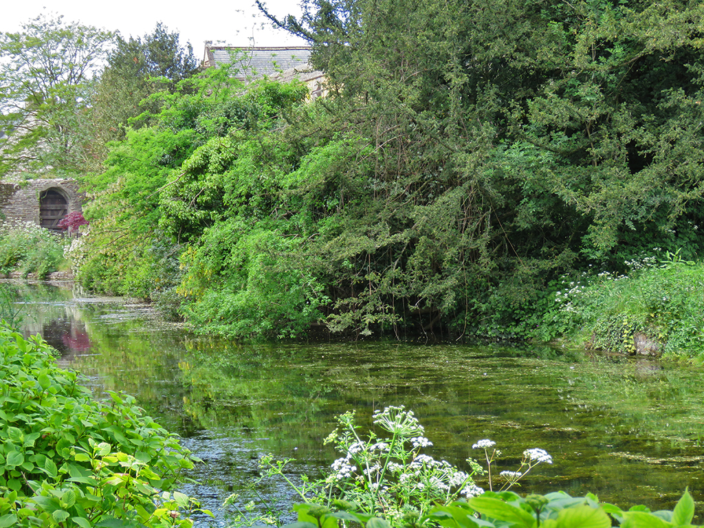
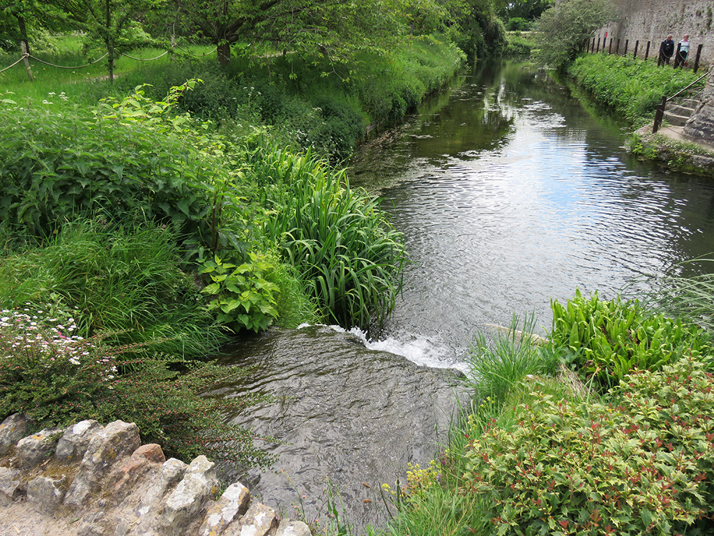
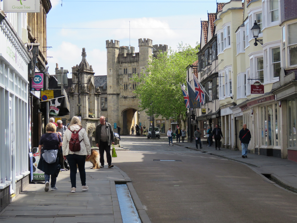
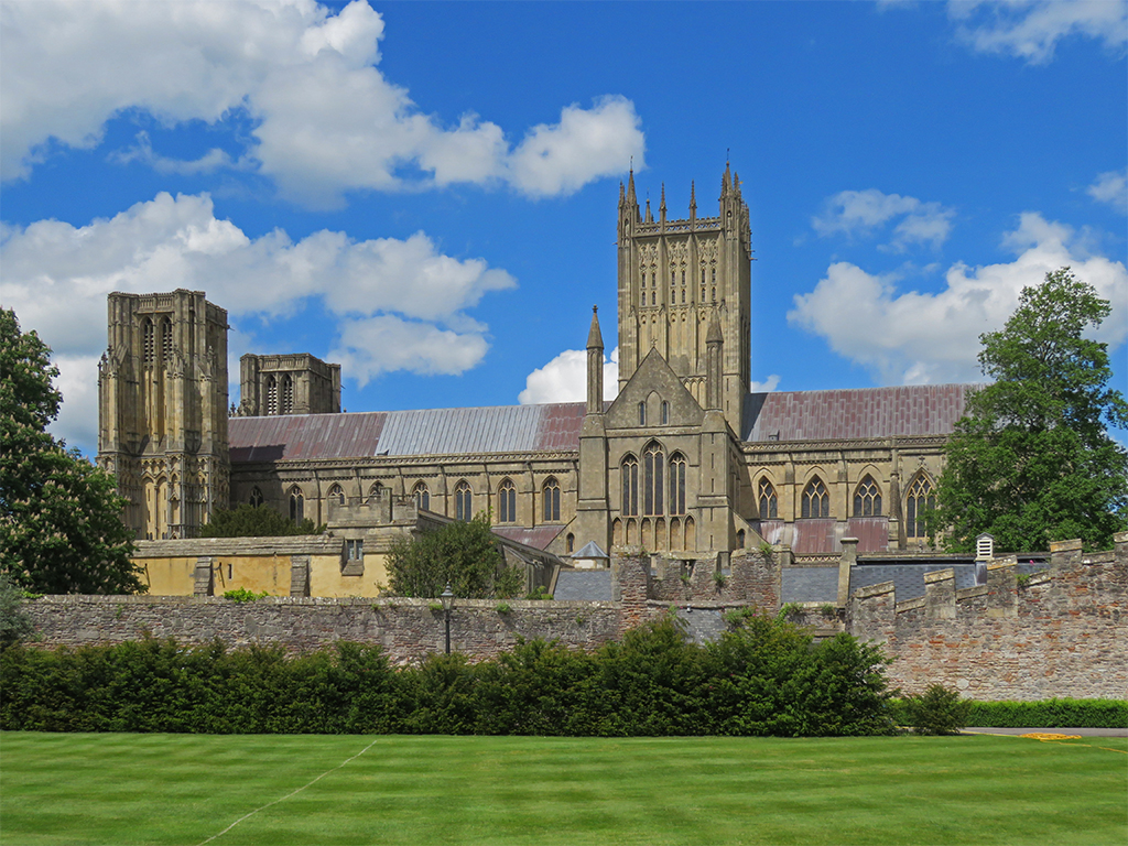
Our next stop was at the historic city (aren’t they all historic at this point?) of Wells [map]. The city is named for the upwelling of water from springs (probably similar to the source of Bath’s water features).
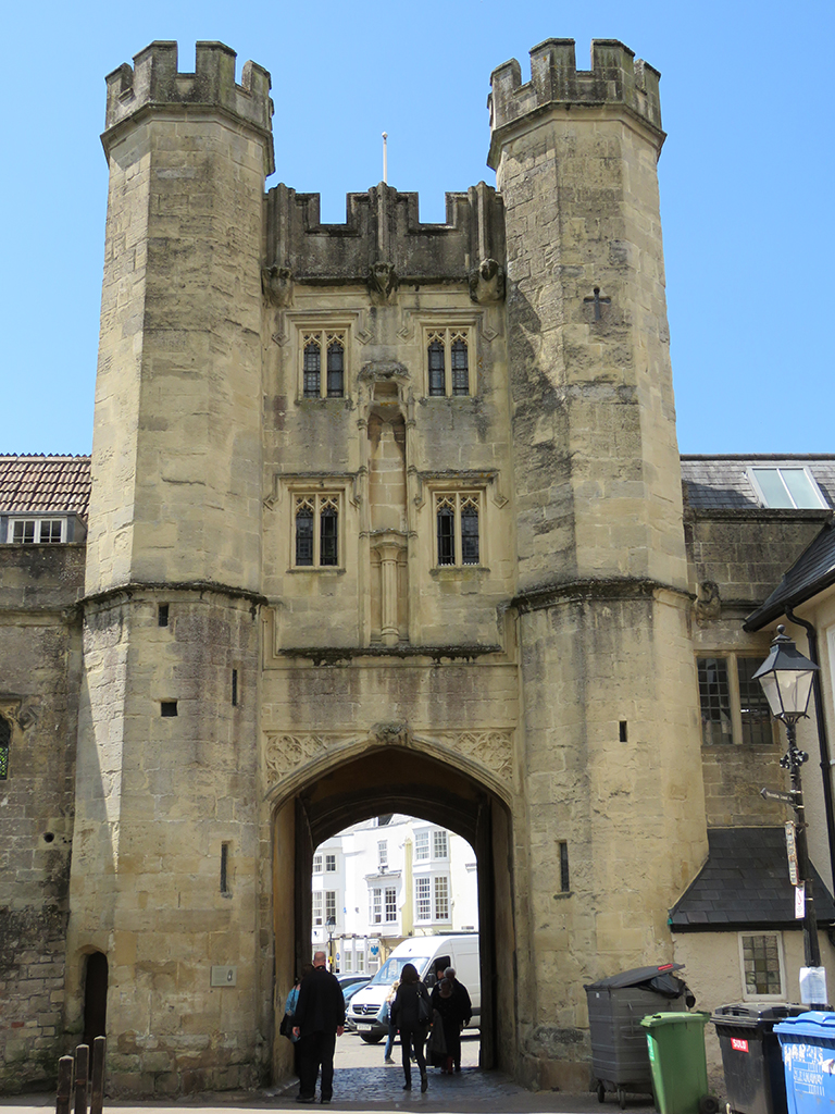
Welcome to Wells. There’s the old city gate, down the road.
It is also the seat of the Bishop of Bath and Wells – what’s known as a Cathedral – so of course we have a big church (though described as “moderately sized” by historians)!
The western facade of Well’s Cathedral was initially completed in the 14th century, though it has been updated as the centuries passed.
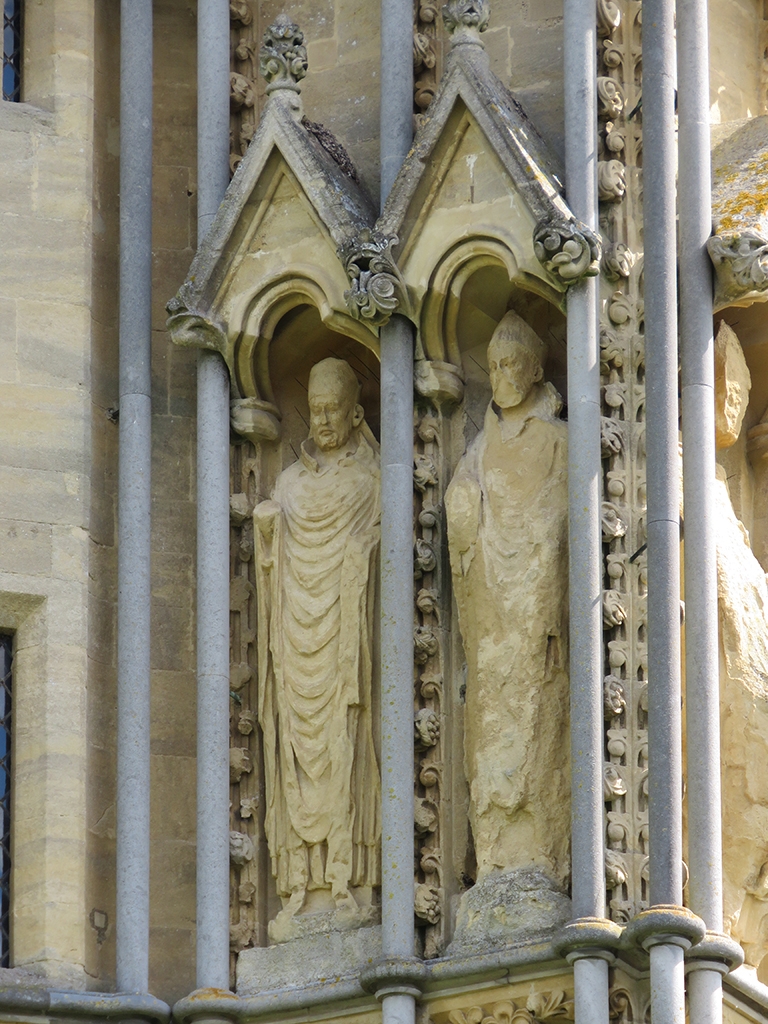
While it lacks the scaled down whimsy of Bath Abbey’s ascending angels, the saints and popes arrayed along the front are quite impressive and the stonework is beautiful.
These statues are well worn but impressive nonetheless, after 700 years.Early English Gothic splendour. This church is one of the few in England to be planned and built all in a single Gothic style.
Inside, the church is beautiful and spacious. Like most Gothic structures, it’s surprisingly airy. Even with somewhat dim light, it never felt oppressive or gloomy.
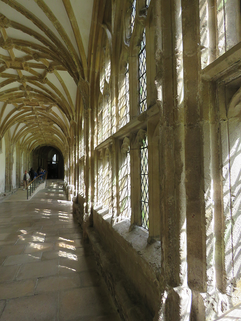
View along one of the cloister walkways. The stone tracery of the windows and the vaulting, while showing their age, are intricate and beautiful.
It might be hard to discern by the photos here, but this space is immense. The architects decided to leave the
The nave is 20 meters (67 feet) in height. I was a little surprised to learn that it is actually considered low, especially compared to large medieval churches in France.
Like most medieval construction, adaptations and changes had to be made as the structure was advanced. Some of this is just because of the simple fact that it took centuries to build these structures. Decades for just the basic functional layout, and then successive additions and adaptations to time and technology. One such engineering stand-out are inverse or “scissor” arches. They were added when the weight of the central tower caused the supports to start sinking. These arches redistributed the load and relieved the stress.
One of the scissor arches that was innovated to save the structure in the 14th Century.
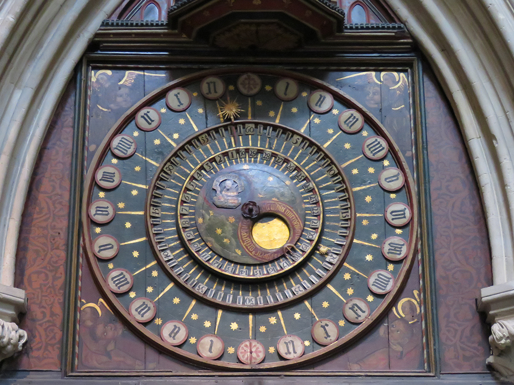
The cathedral also claims to have one of the oldest clocks in the world (although the internal mechanism was replaced in the 19th Century, it has it’s original face, and its time and other indicators were not interrupted). The face has a 24 hour dial and indicators for the phase of the Moon as well as the Moon’s age – or days since the last new moon. Above it is a miniature display of jousting knights that “perform” each hour.
The original 14th Century clock face. I can say that, at least according to my smartphone, the time and moon phases were accurate.
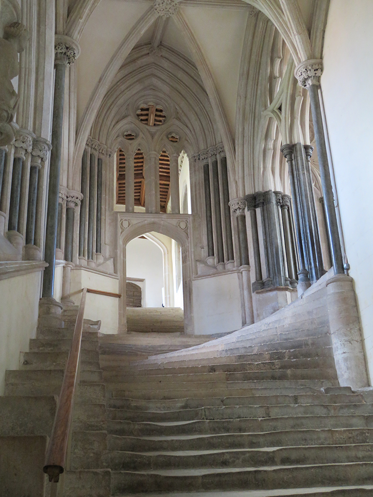
The 13th Century chapter house was also impressive. Chapter houses were meeting rooms for church officials, and this one is still used for social events and other meetings from time to time.
The original stairs to the chapter house are worn down and smooth on the left side.More impressive vaulting and tracery.
The scope and intricacies of the church are truly monumental, and I encourage you to check out more details at the Cathedral’s official website: https://www.wellscathedral.org.uk/
Wells Cathedral on a gorgeous Spring day.
Adjacent to the cathedral is the Bishop’s Palace, home to the bishops of Wells for centuries (though these days, most of the palace is a museum and public space). Stay tuned for Part 2!
Hi everyone. A brief interruption to my UK trip updates, if I may…
The end of August found me and my boss in India, of all places, to provide some software and process training. The approval and planning happened with relatively short notice just as our workload was increasing, so I wasn’t even thinking about the blog in the run up to the trip.
But in any case, here’s a selection of photos and the eBird lists for the week+ I spent in Bengaluru!
[Note to Tumblr followers: I realize the WP photomosaics don’t always work right. I’ll try to reformat and repost for you as soon as I can!]
We rode in these a few times through the week. The drivers get coupons/commissions for taking you to certain merchants, so be firm or you’ll take detours all day.
State Parliament building. Our driver was very proud that he got his drivers license in this very place. Apparently the citizens hold it in high regard!
Mahatma Gandhi statue on the parliament grounds.
Banglaore Palace main gate.
The palace interior is beautiful. The residence is still in use by the royal family, decendants of the King Chamaraja Wodeyar, of the former Kingdom of Mysore.
The palace was built in a Tutor-revival style on the outside, but the furnishings are Victorian and Edwardian.
Courtyard in Bangalore Palace.
Glass light fixture detail.
Sacred cow statue outside the palace,
Bangalore Palace was built by the British for the Mysore Royal Family in a Tutor revival style.
State Library near Cubbon Park. I was sternly “told” by a local policeman not to enter the library grounds, although it was clearly open and had visitors at the time.
More of Cubbon Park. I visited the park several times, as it was a quick walk from the hotel.
Still Cubbon Park. This has been a protected green space for over 150 years.
August 28:
Non-birding day
More of MG Road (that’s my boss Morris in the blue shirt, by the way).
Commercial Street is the market many locals use. There was a diverse population all conversing, haggling, and eating together.
Commercial Street area.
One of many temples in the market district.
The temples are ornate and colorful.
Here you get a sense of the numerous Hindu pantheon.
There are many large Christian churches in Bangalore, too. This is St. Mary’s Basilica “Our Lady of Good Health.”
Black Kites are found everywhere over the city, sometimes in the dozens. Here is one perched in Cubbon Park.
White-throated Kingfisher with a freshwater crab.
White-cheeked Barbet taken just next to the main road by the hotels.
White-throated Kingfisher pair.
ISKCON temple (Hare Krishna).
We were not allowed any photographs inside the temple. It was dumbfounding. The paintings and goldwork and the sounds of prayer and drums…
Little Cormorant at Lalbagh Botanical Gardens.
Spot-billed Pelican at Lalbagh Botanical Gardens
Little Grebe at Lalbagh Botanical Gardens.
Shiva statue (and temple). This is hidden behind a mall and busy street! It’s like a hidden dimension as you walk through a parking garage and back alley and open up to THIS.
Lord Shiva. We got to take part in a (tourist version) ceremony and learned some chants for meditation.
There is a population of Bonnet Macaques in the park. They will steal your food and shinies if you don’t watch it!
This macaque was soo sleeepy.
Although the pathways were on the whole, well maintained, I did mangage to trip and fall from a hole as I was too busy tracking a bird to watch my feet!
Parting shot of a very angry and dominant Bonnet Macaque. He was quite vocal and demonstrative.
The bird life was suprisingly sparse in the park. This is one of only a few shots I got. This is a Red-whiskered Bulbul.
Bonnet Macaque looking for food.
Rural India, far below. I don’t have any photos from the road down there.
Breath of fresh air after the noise and pollution of the city
One of the other hills from our vantage point.
Nandi Hills, about an hour north of Bengaluru has some spectacular views! These are some of the oldest rocks on earth, over 3 billion years old!
Another of the Nandi Hills.
The remainder of my time since coming home has been recovering from jet lag, getting over a head cold, and prepping and waiting out Hurricane Dorian.
I’ll get back to the UK recaps as soon as I can. Stay safe and see you later!
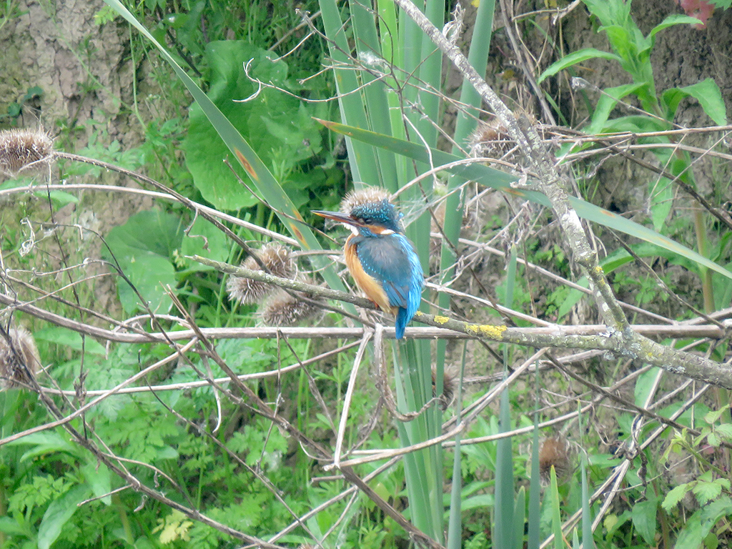
Since my planned birding day near Plymouth didn’t work out, I took Darren’s advice and checked out the Slimbridge Wetland Centre (also referred to as “Wildfowl & Wetlands Trust”) in Gloucestershire [map]. There’s a lot going at this remarkable place, but for birders (particularly out-of-country ones!) it was a bit confusing. The first part, near the visitor center, is a series of exhibits showcasing birds from around the world, including local birds! And although these birds are ostensibly “clipped” to keep them from flying free, I observed on a few occasions these birds making short flights that could carry them out of their “enclosure” habitats. I’ll post my eBird link after the photos (presented without commentary beyond captions), but take some of the duck and geese species with a grain of salt. I tried to weed out the “captive” species, but there may be a few of the ambiguous sightings that got left in.
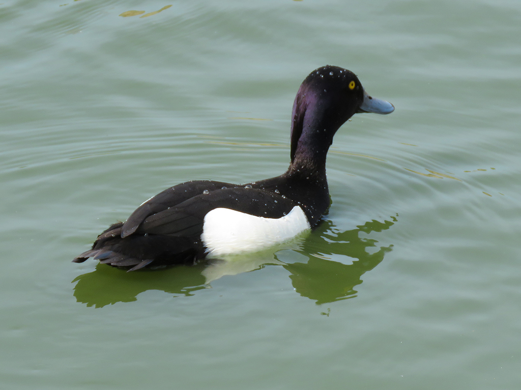
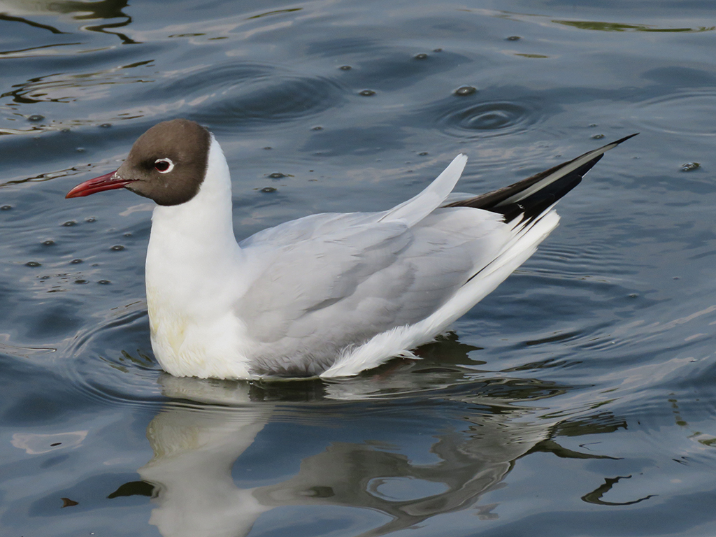
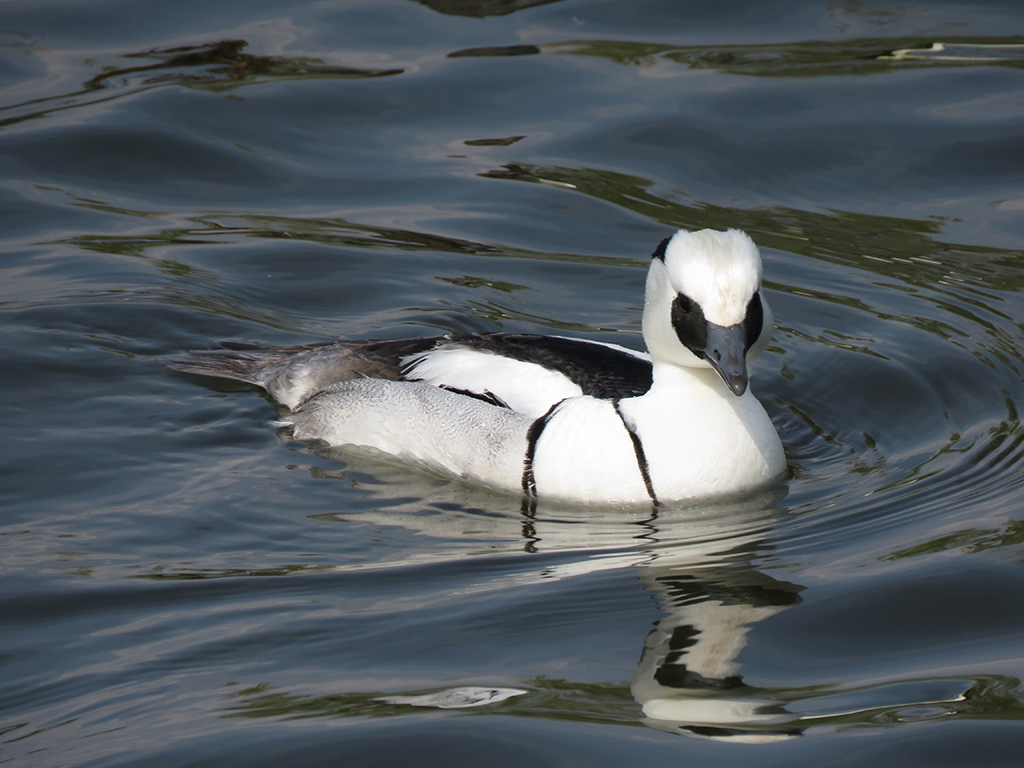
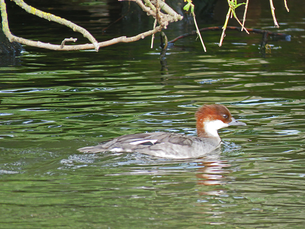
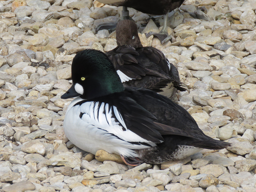
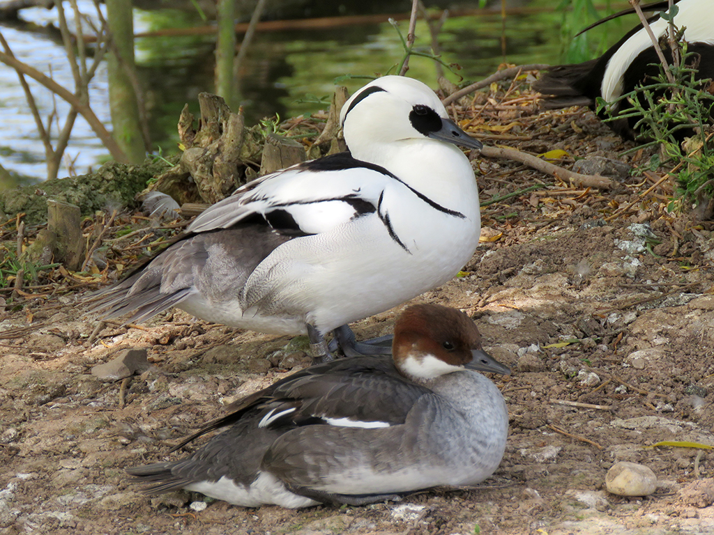
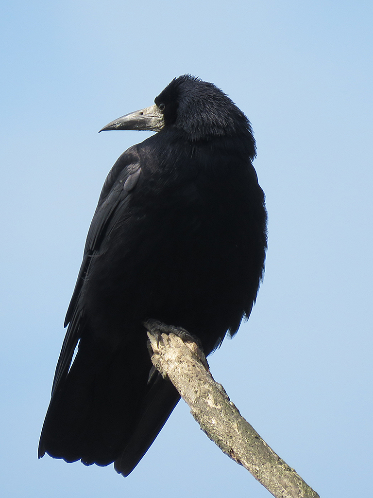
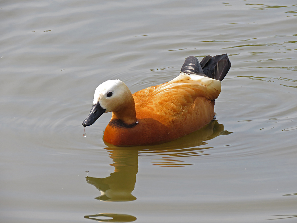
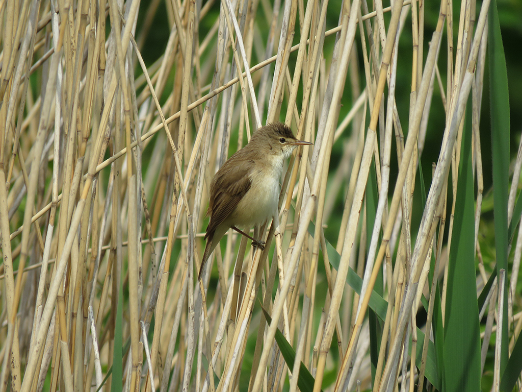
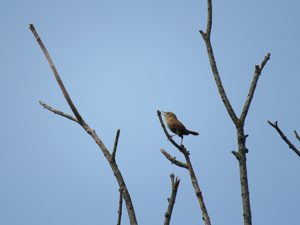
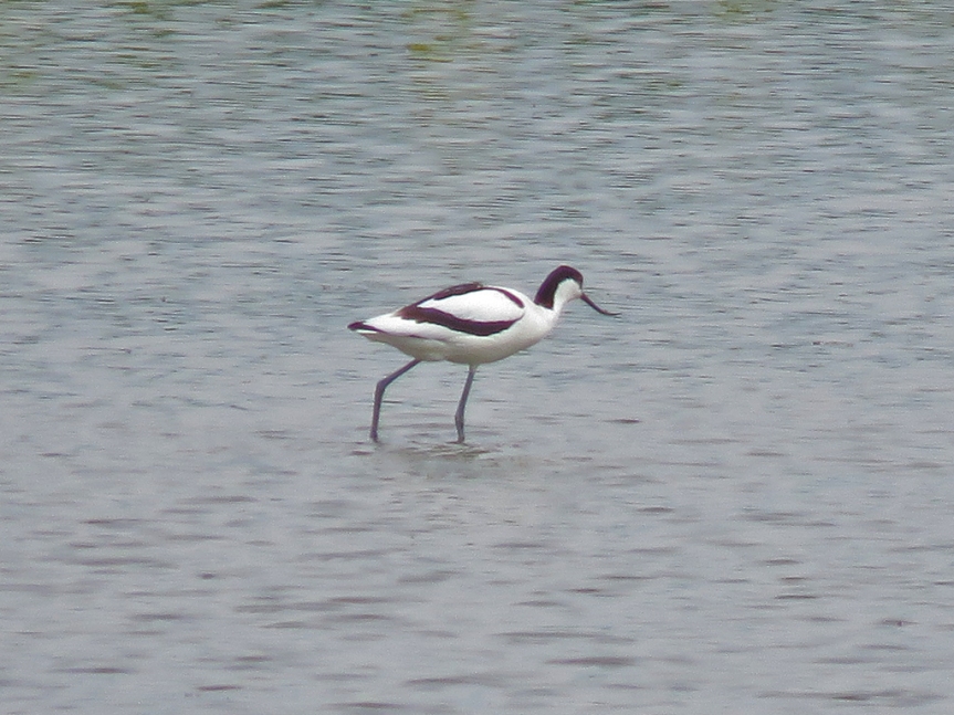
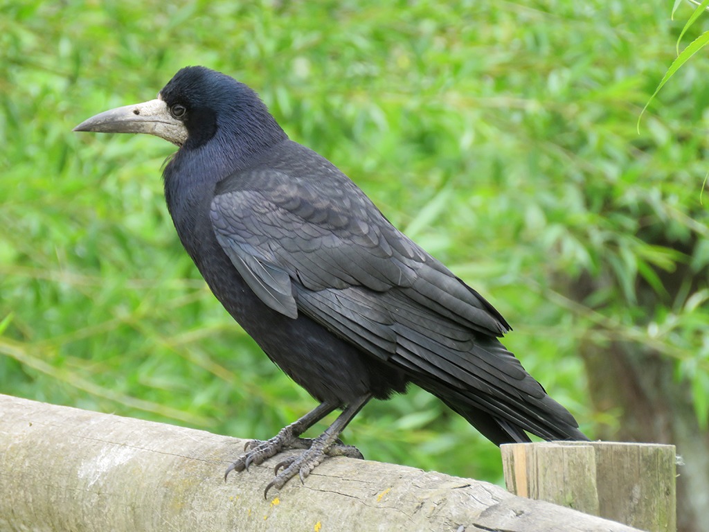
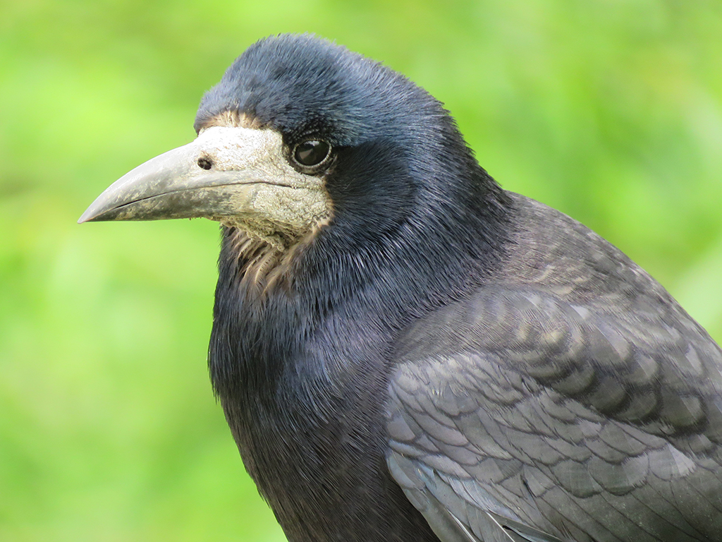
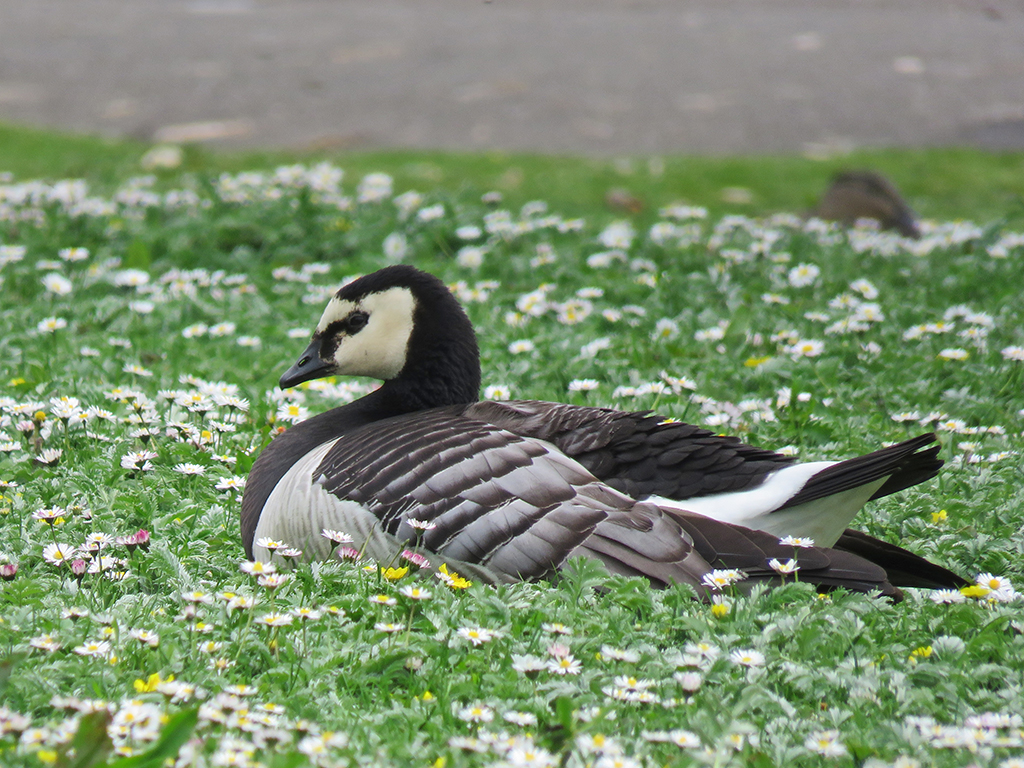
Tufted Ducks were not rare during our entire visit, but photo opportunities of this species were. This one was at the visitors’ centre, but should be representative of the many I did see out in the wild.Black-headed Gulls are possibly the only – um – black headed gulls without black heads. It is actually a dark chocolate brown. I’ve seen this species as a vagrant in the USA, but this is a native, free-flying bird.The Smews at the visitors’ centre seemed captive, but a few of the birds flew to adjacent pools, so I listed these, but perhaps I shouldn’t have. I’ve not heard anything from the eBird reviewer on the matter. This one is a drake.Female Smews are much different looking than the drakes (males).Common Goldeneyes are also seen in the USA, this pair were at the visitors’ centre, but I saw some flying out in the marshes later in the morning.A Smew couple on land.Rooks are common enough around the UK, and the ones throughout the park were quite photogenic and accommodating.Like some of the other duck species, Ruddy Shelducks were at the visitors’ centre pools (like this) and out in the wetlands, too.Waterfowl dominated the visitors’ centre, but once out in the park and on the trails, there were more songbirds, like this Reed Warbler.The tiny Eurasian Wrens made up for their size with loud, ringing voices. The song is reminiscent of Song Sparrows in North America. This caused me a deal of confusion throughout the trip.Photos out over the marsh and meadows from some of the blinds were tough. This shot of a Northern Lapwing and many of the upcoming shots are heavily cropped.One of about a dozen or so Pied Avocets feeding in the shallow water.While not listed as particularly rare, this Eurasian Spoonbill seemed to be causing quite a stir among the other birders at the blind.In the wooded area near one blind, I saw this one-legged European Robin. It seemed to be managing fine, but I wonder what happened.At the next blind, it took some patience to wait for one of the Common Kingfishers to arrive back at its mud bank cavity nest site.Another handsome Rook. This one was near some picnic tables, looking for an easy snack from the park patrons.A close-up of a Rook. It’s thought that the partially naked face is due to Rooks being opportunistic omnivores, not ones to pass up carrion. Like vultures, this avoids facial feathers being fouled by blood and such.Back at the visitors’ centre, this Barnacle Goose flew in and landed on the lawn to rest.Many of the birds at the park (including the visitors’ centre) are breeding and had chicks, like this Mute Swan and its cygnet. This is one reason it is difficult to completely exclude the exhibit birds from lists. They are obviously breeding and some are flying about.
I’ve left off photos of some of the more exotic birds – like the Nene, a South American bird called a screamer (for good reason!), and some others that are clearly not UK or European birds. I may post them as bonus or extras in the future.
Here’s the somewhat confusing eBird list for the day. Ruth and Mrs. Lonely Birder came to pick me up after shopping in nearby Gloucester.
[Note: I realize it’s taking me some time to get through these posts. Please bear with me. It’s been a hectic summer]
May 18, 2019
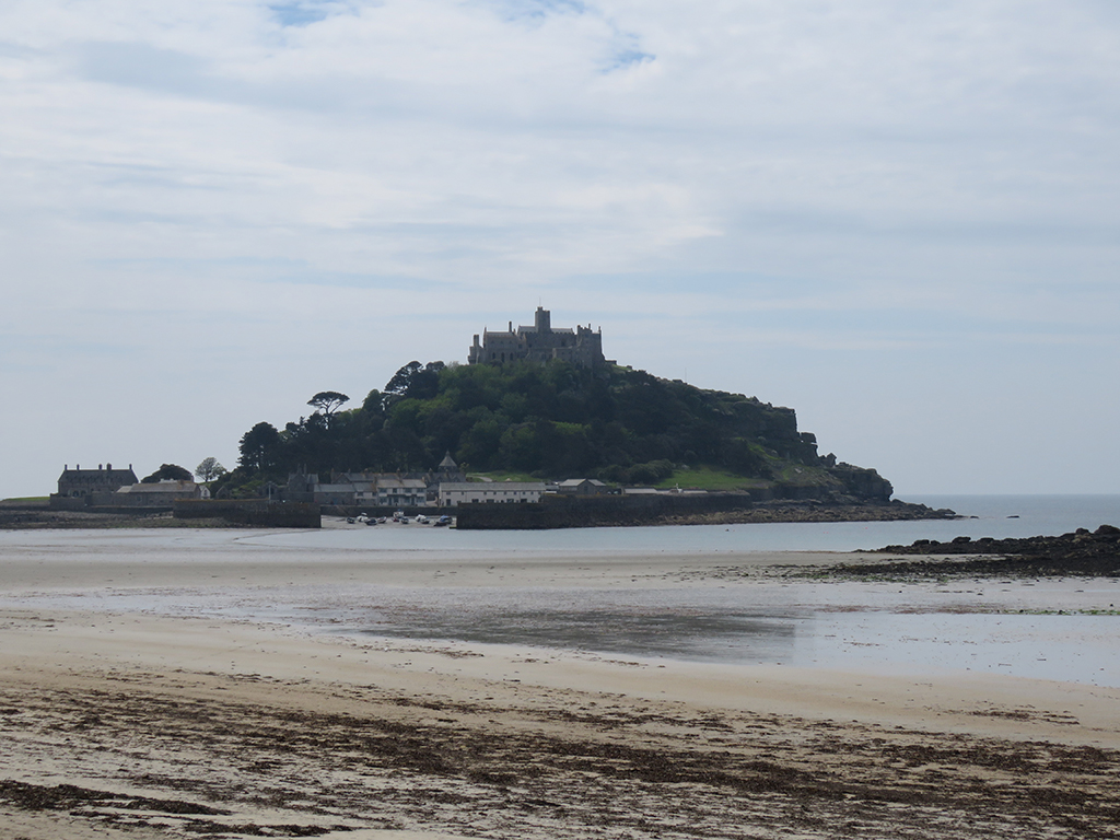
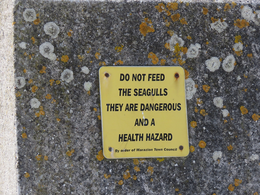
Continuing our travels along the south coast of England, we drove back through Cornwall and to the ancient village of Marazion [map]. Off shore on the island of Saint Michael’s Mount is a castle and church that can be visited by foot during low tide. When the tide comes in, the causeway is submerged and the mount is only accessible by boat or amphibious vehicle.
A view of Saint Michael’s Mount, looking at the harbor side.
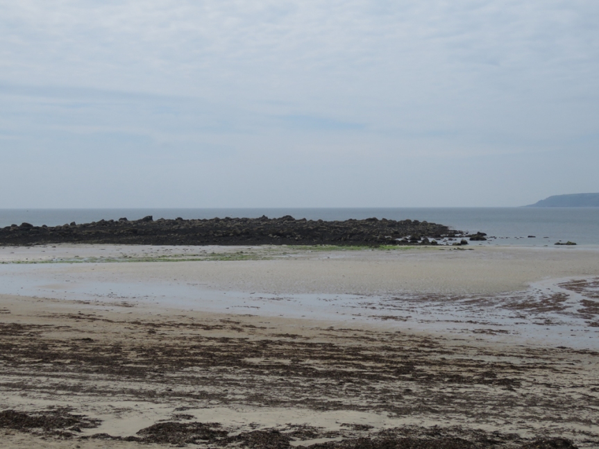
The beach itself is quite flat, and when the tide is out one can wade quite far in places. A beach like this would be stacked with people, blankets, chairs, and fishing poles back home in Florida. Here, the beach was mainly empty, with people enjoying sea views from benches, restaurants, and shops from the village.
You can see how wide the beach is, and the waters beyond were quite shallow.
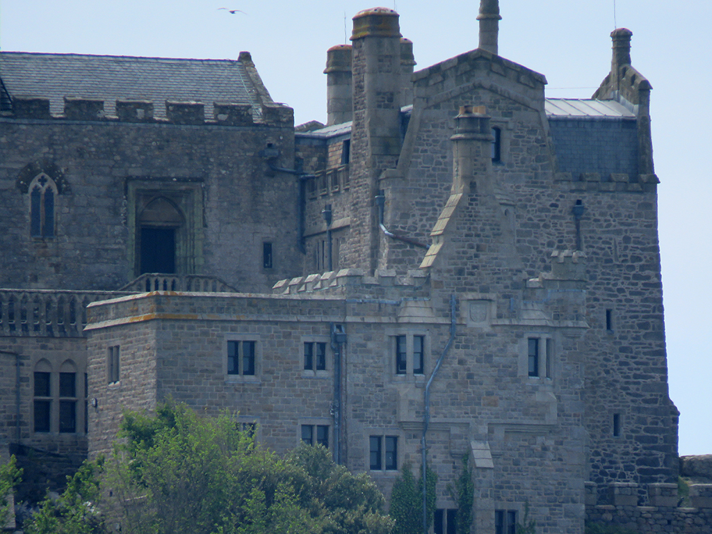
The castle and chapel are impressive, even at a distance and I imagine the views commanded from this vantage-point are impressive. People do live and work on the island, and an order of monks is active at the chapel.
Part of the castle and the chapel atop Saint Michael’s Mount.
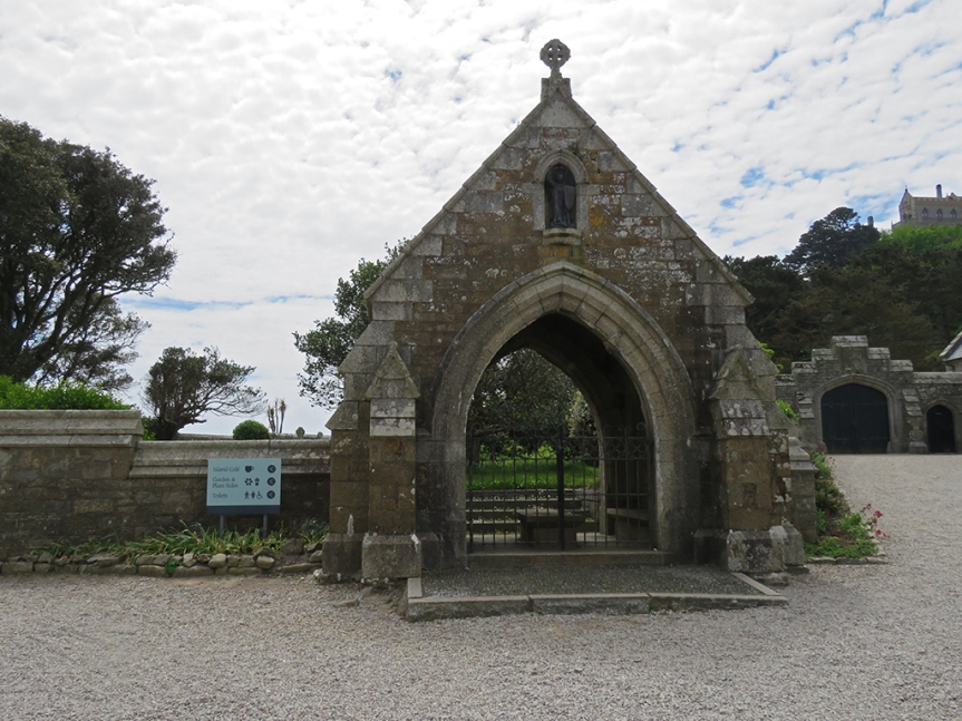
The main part of the island was gated and closed, which seems a shame as there are extensive gardens and a museum I would have liked to see. I hear the geology is unique and impressive as well. But it was a lovely diversion nonetheless, but we couldn’t stay long as the tide was about to come in, which threatened to strand us on the island (or at least have to hire a boat) as the causeway would be inundated.
Access denied. Sorry to have to go, Saint Michael’s Mount…
Meanwhile, back on the beach…
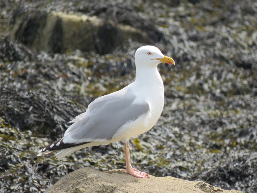
Forewarned is forearmed?Aw, this Herring Gull looks harmless!
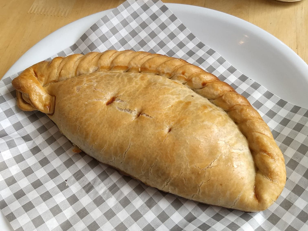
We walked back to the beach and then into Marazion, and had lunch at a cafe that had some local fare, known as a pasty. Pasties are a pastry filled with meat and root vegetables. Traditionally, they were miners’ food. The thick crust around the edge serving as a handhold that wasn’t normally eaten since the miners’ hands might be contaminated by arsenic or other poisonous substances related to mining.
Lovely pasty! (Thanks, Ruth, for the photo!)
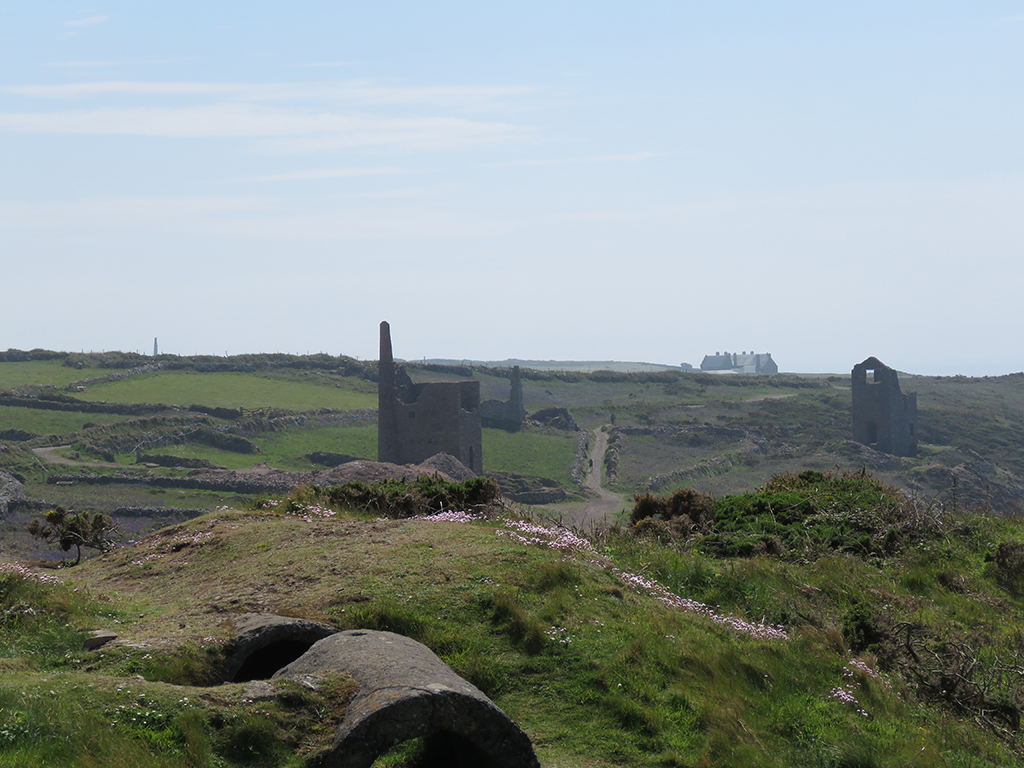
From Marazion we worked our way west along the coast until we reached the ruins of the Botallack Mine, not far from the town of St. Just [map].
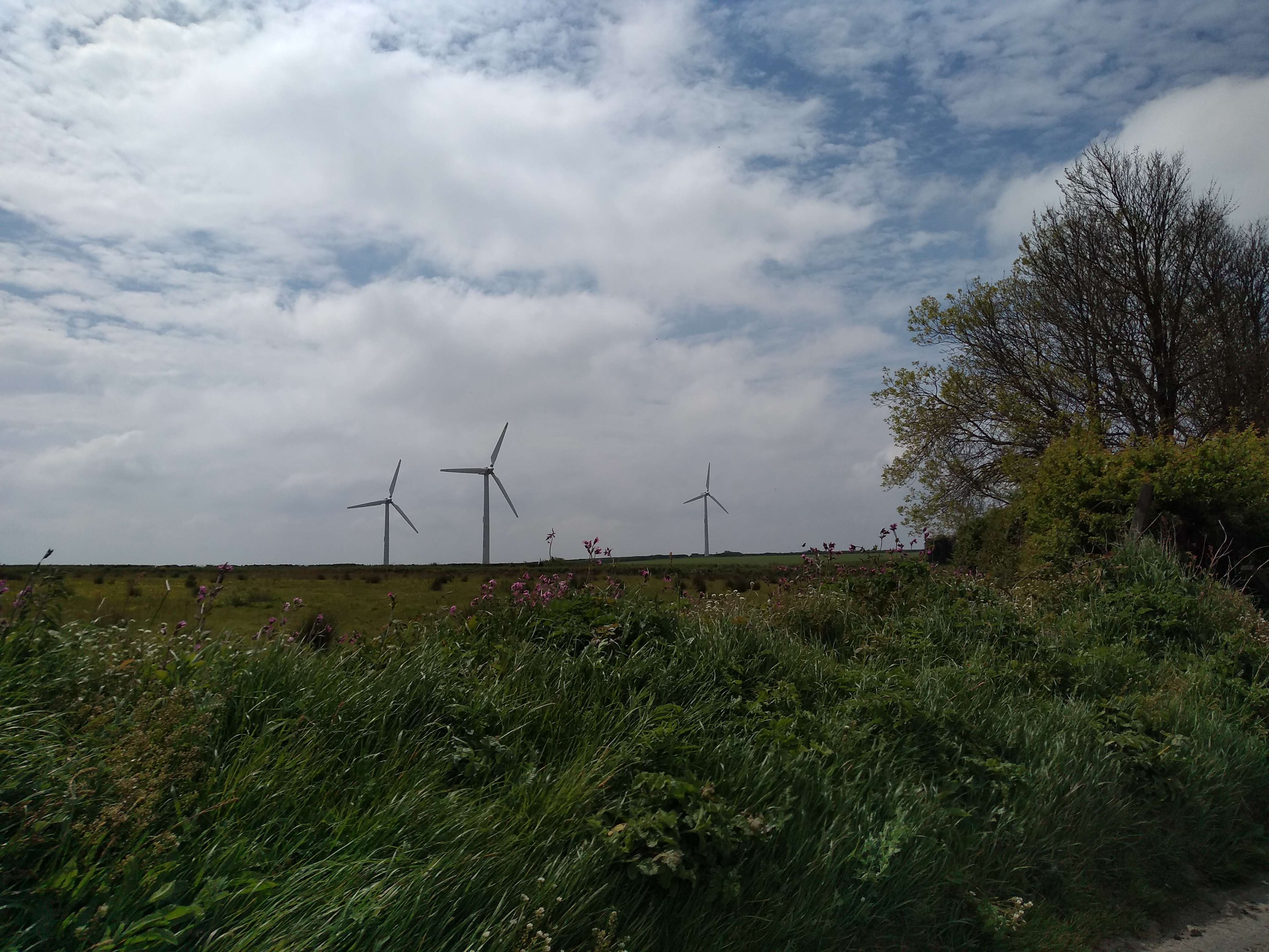
Windmills are perhaps the most visible sign of how the UK has moved away from coal generated power. While we were there, the country had just had of a couple of weeks were no coal at all was used!
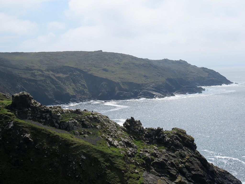
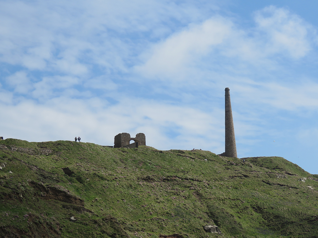
This stretch of coast has to be one of the most dramatic and impressive sights we saw in our whole trip. The juxtaposition of the natural beauty of the rocky coast and dramatic cliffs with the many abandoned mining structures makes for a nearly unparalleled visual experience. Add in the roar of the waves on the rocks below and the wildflowers blooming, and you can imagine what an experience this was.
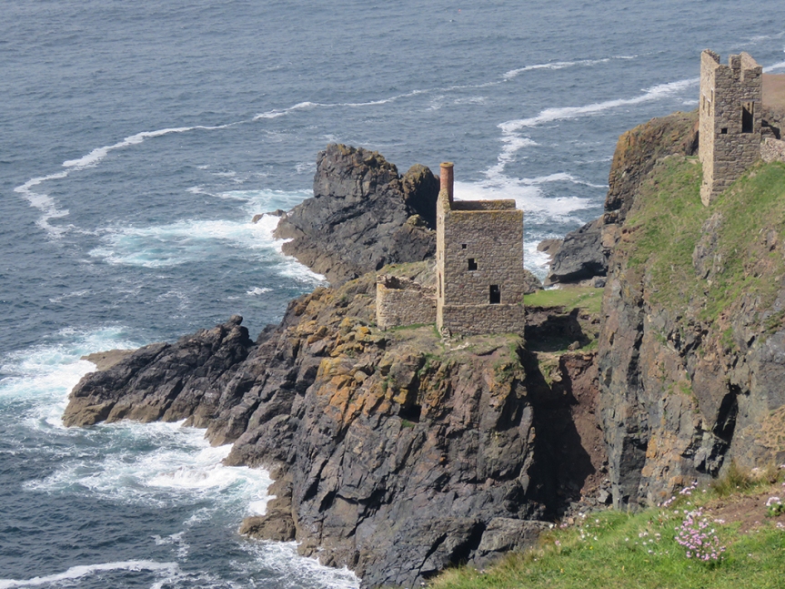
The remains of the mining engine houses from the Botallack Mine.
As we approached the cliffs, a low fog was dispersing along the coast, which made the scene even more fantastical.
In ways, this landscape seemed a convergence of the sea cliffs we saw in Wales, the flowers and grass of Dartmoor, and the ruins of Minions. Very England.
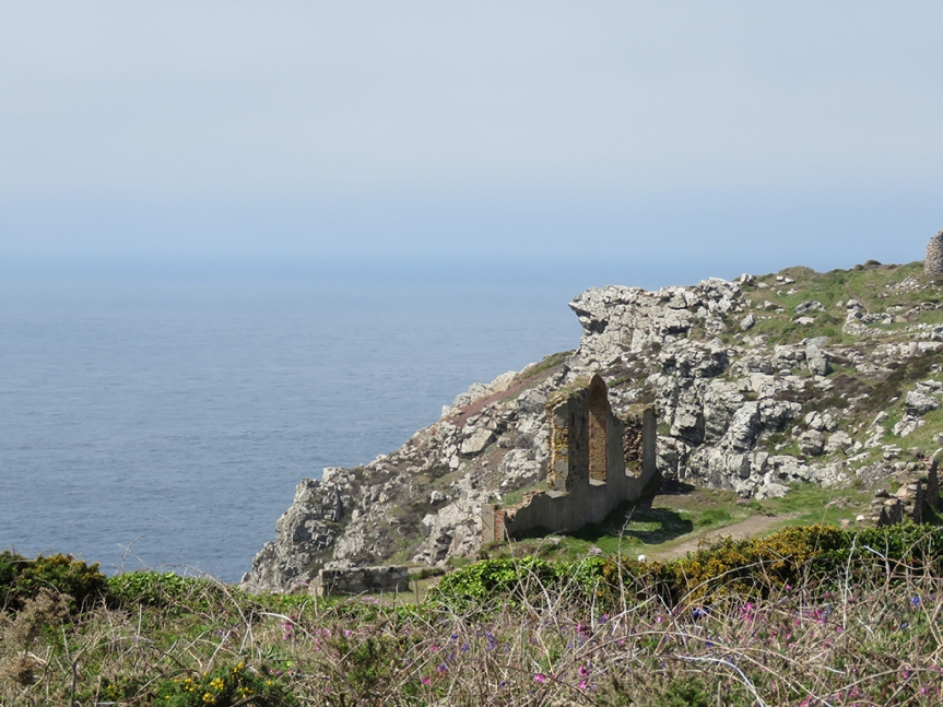
Seabirds were circling below (Northern Fulmars, as it happens) as waves and foam churned on the rocks. We were only able to walk so far down along the cliffs due to trail closures for safety.
From these structures, miners actually tunneled under the seabed up to 1/2 a mile (800 meters) to get the valuable copper ore, even breaching the ocean, flooding the mines.It would be hard to find any safe harbor approaching this part of the north coast of Cornwall.
The scope and scale of the cliffs are hard to grasp from photos alone. They are hundreds of feet high, some with very narrow places to walk out on. The lingering fog helped confuse the distance cues a bit, but added to the drama.
Most of what we saw in the UK was spectacular and I’d trade none of it, but Cornwall definitely stole a bit of my heart.
We were very near both Penzance and Land’s End, but we stopped at neither. On a future visit I would like to spend more time in this part of England and take it all in, natural and human.
Darren says this is looking toward Sennan Cove, and Land’s End (beyond).
We spent some time marveling at the scenery before climbing back out, past the mining houses and the furnace ruins, looking up at smokestacks that seem to defy gravity and the elements.
Here’s more sense of scale: The two small vertical objects on the left are people standing on the cliff edge.
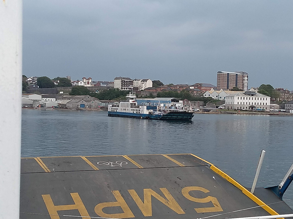
As we made our way back toward Bristol, we crossed into Plymouth by way of the Torpoint Ferry, rather than the bridge. It was fun.
Two boats run, one in each direction, and both were full. Photo thanks to Mrs. Lonely Birder.
Mrs. Lonely Birder and I got out of the car and went up on the deck and enjoyed some fresh air and a look at a few Royal Navy Ships. The ferries run on cables between both sides which is a safer, if more boring option for ferries ;-).
Some Navy ships in the harbour. Photo thanks to Mrs. Lonely Birder.
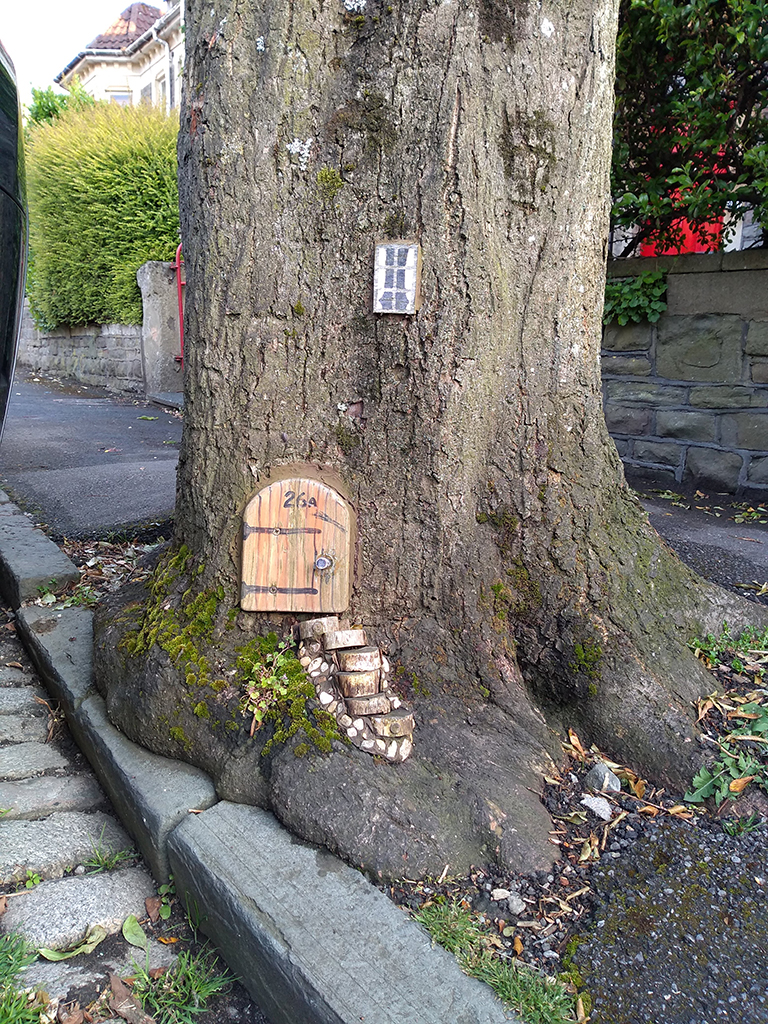
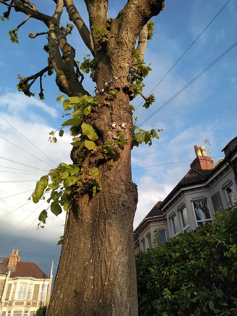
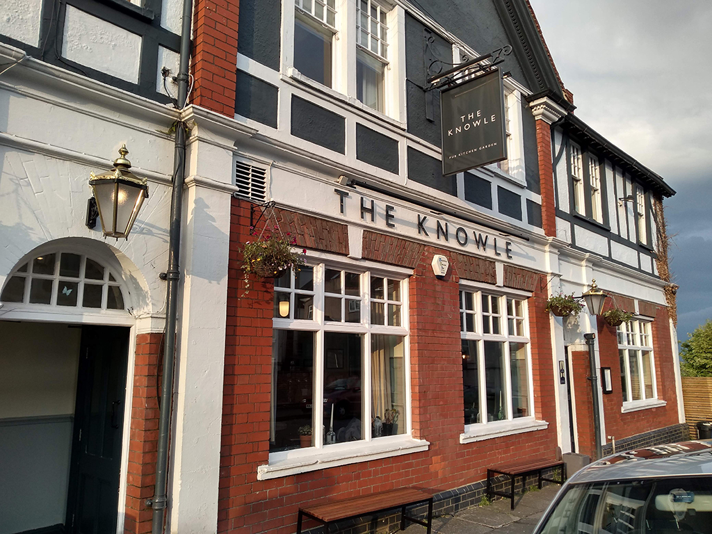
We eventually got back to Bristol and walked to the local pub (The Knowle) so those that imbibe could have a pint and we unwound a bit. On the way there, we passed some trees that have been decorated like fairy homes!
We didn’t knock to see if anyone was home. Photo thanks to Mrs. Lonely Birder.This tree ended up looking a bit Entish, if you ask me. Photo thanks to Mrs. Lonely Birder.
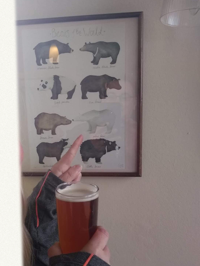
We ended the day out at the pub, in which Mrs. Lonely Birder saw a familiar friend, reminding us of our previous epic trip to Churchill, Manitoba! I’ll leave you with a couple of parting shots.
The local pub. We didn’t stay long, but it was sort of a checklist item of ours. Cheers, mate!It was pure cool to have a Polar Bear drawing by our table, linking our life-time trips together!
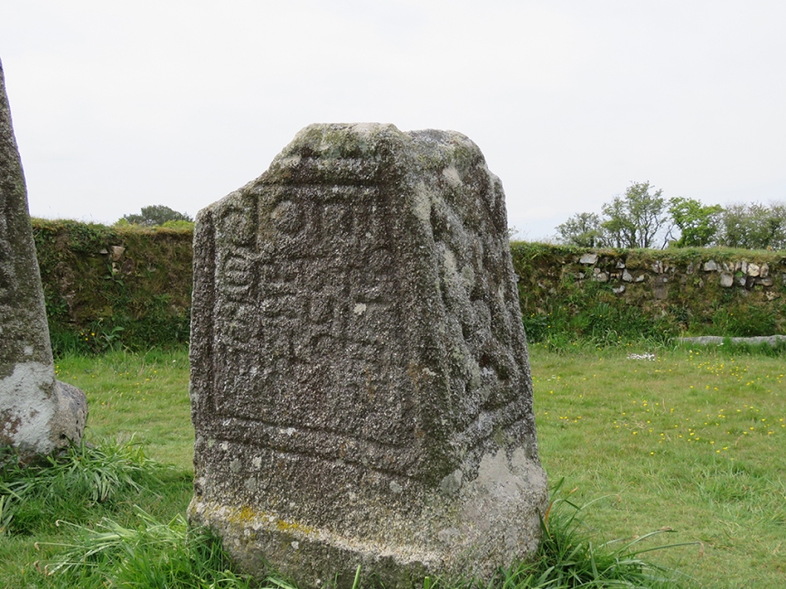
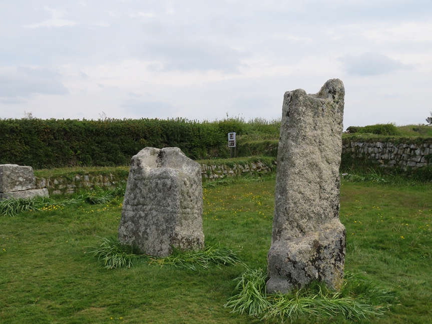
After a night in Plymouth, our adventures took us further afield into Cornwall and Bodmin Moor [map]. Driving past the ever present windmills and fields of the English countryside, we first stopped at a pair of stone monuments. These would have been the bases for wooden crosses, one of which bears an inscription commemorating King Dungarth (Doniert in Latin), the last King of Cornwall who is purported to have drowned nearby in 875 AD.
King Doniert’s stone is one of two “cross shaft fragments” that were raised upright during excavations in the 19th Century.
According to English Heritage, the Latin inscription on the shorter stone (Doniert’s) is translated as “Doniert has asked [for this to be made] for his soul[’s sake’]”.
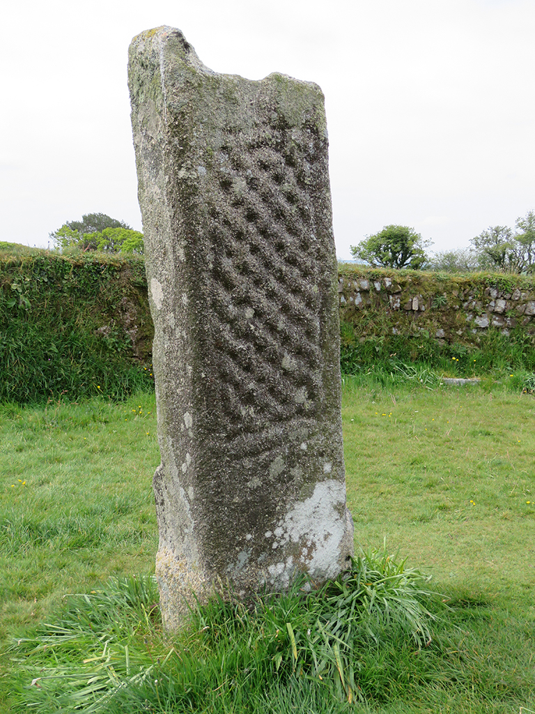
The taller fragment has no commemoration, but its proximity to King Doniert’s stone and the discovery of an underground cross-shaped tunnel beneath the stones indicate this was an important early Christian site in the 9th Century.
This stone fragment is quite a bit taller, but bears no specific inscription. Both stones are easily accessible on the roadside and the stone enclosure shows evidence of cows and sheep using the area to graze.These sides of the stones seem more weathered and eroded.
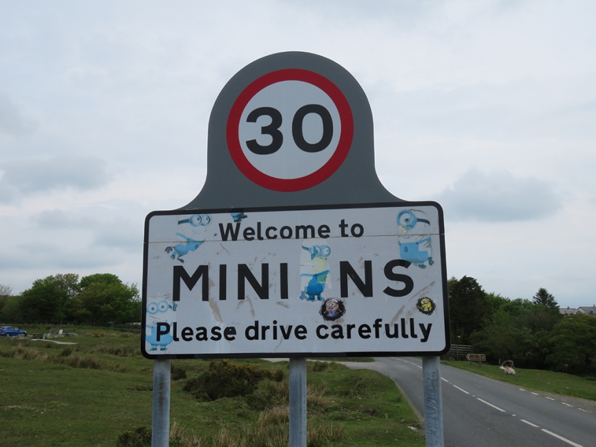
From these ancient memorials, we made our way along the southeast edge of Bodwin Moor to the village of Minions. In this post-Despicable Me world, it was all too easy to snort-laugh and bring images of Gru’s mostly loyal underlings to mind. It seems to be a common enough thought.
I don’t know if the stickers were sanctioned or not, but I suppose it was inevitable.
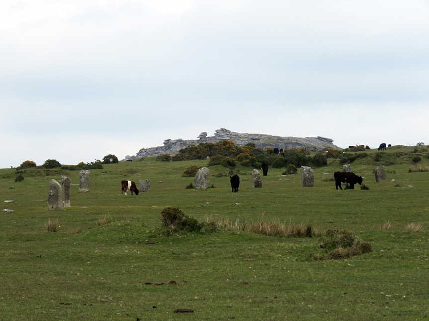
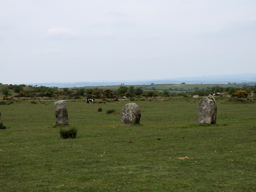
The biggest attractions here are The Hurlers stone circles and a natural landmark called the Cheesewring. The Hurlers are a set of 3 remnant stone circles and a pair of stone markers (“The Pipers”) from the Bronze Age. Many of the stones have been eroded away or “borrowed” as building material through the centuries.
The exact age of these stones is uncertain, but they are clearly ancient and well weathered. Some have suffered the effects of close-grazing cattle, which helps weaken the stones’ bases, causing them to tumble over.
The three circles are nearly in alignment and thus likely intentionally related. The local legend has it that the stones are in fact transformed men who dared to play the ancient game of Hurling on a Sunday and were cursed. It must have been some game!
More stones with cattle grazing and the Cheesewring in the distance.
Close up, the stones are placid, yet evocative of ancient and mysterious cultures and beliefs. Through the ages people have ascribed all manner of mystical energies associated with stone circles, and it’s easy to see why. It’s awe inspiring to see this ancient handicraft, abandoned yet so accessible.
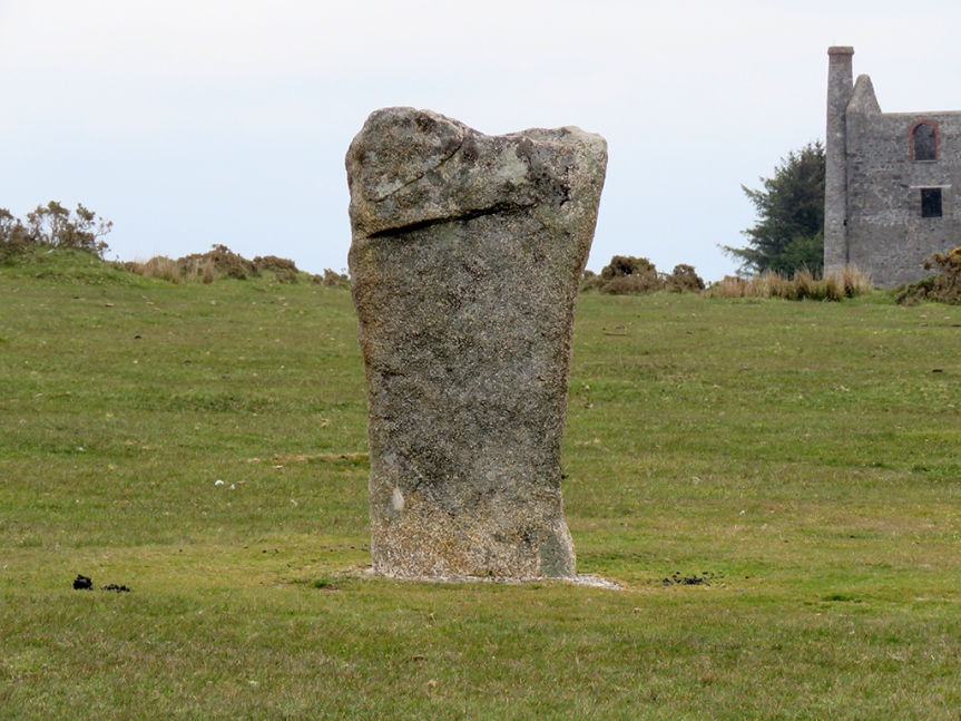
One of the taller and more intact stones.Looking out from the center of one circle to a trio of stones.
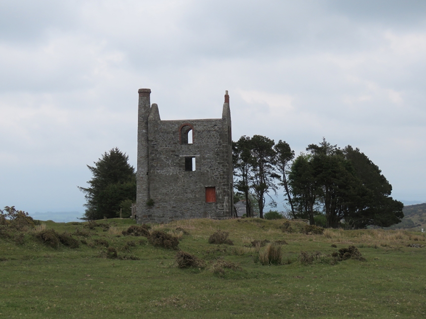
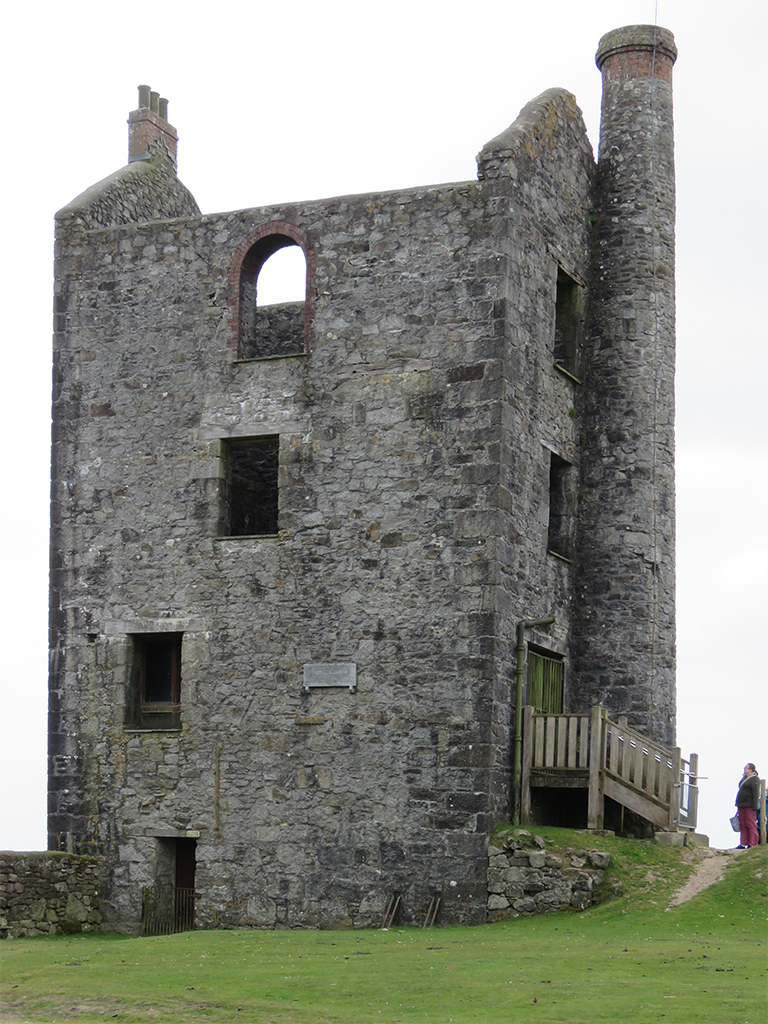
Nearby the stones were several building ruins. These used to house large steam engines, which helped drive pumps to keep water out of the mines as well as circulate air.
One of the mining engine houses. This is a not-uncommon sight in much of Cornwall.
Much of the area beneath the Hurlers consists of mining tunnels, and some of the rumpled appearance of the landscape is due to subsidence. It’s unlikely one would simply drop through the ground casually walking, but it was perhaps best practice to avoid any obvious “dips” or potholes.
This ruin serves as a small local museum, but it was closed while we were there. These sites are well preserved as a part of England’s heritage.
It’s nearly impossible to separate mining from Cornwall, or indeed much of southwest England and Wales. Just about every site we visited had evidence of mining from the 18th through the 21st Century.
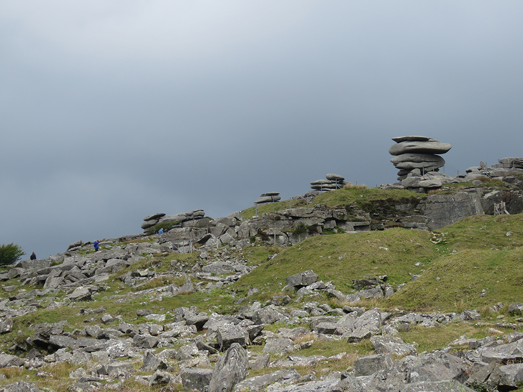
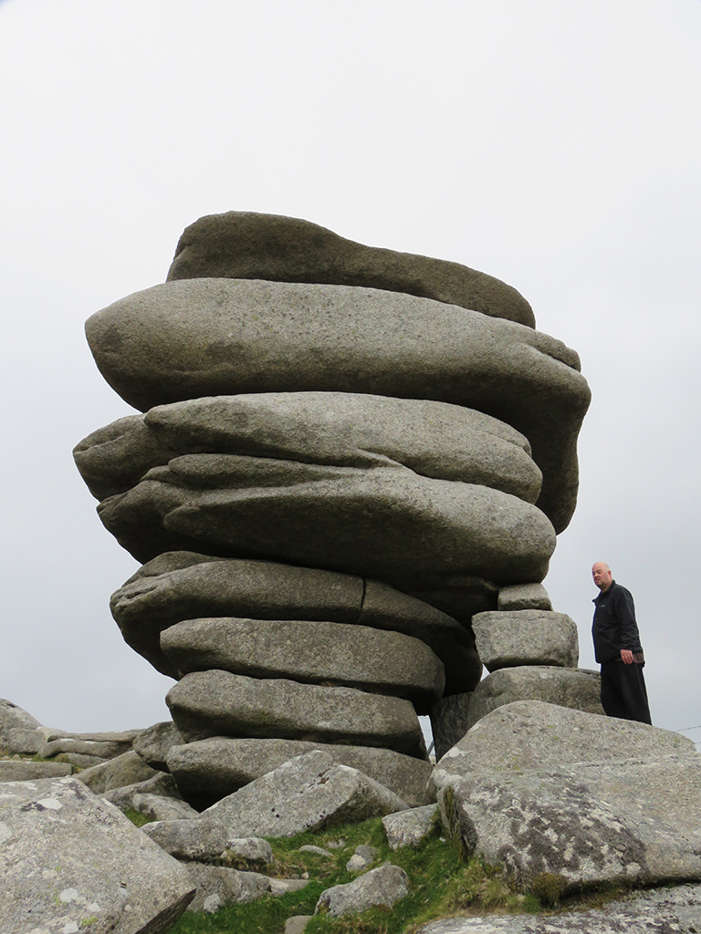
After taking our fill of the Hurlers, we made the hike up Stowe’s Hill toward the Cheesewring, one of several granite outcrops sculpted by the wind over countless years. These are not artificial structures.
The Cheesewring (on the right) is the more prominent of several natural artifacts that make up the tor on Stowe’s Hill.
The Cheesewring gets its name from it’s somewhat similar appearance to cheese slabs that were pressed in its namesake device generations ago.
Here you can see Darren standing by the Cheesewring, for a sense of scale. The small stack of stones just in front of him was placed there as a potential aid should the larger stones fall over – it is not actually touching the Cheesewring.
The top of the tor overlooks the countryside and some well used granite quarries. Darren says that a lot of the granite here was used in London, particularly for Tower Bridge. The top of Stowe’s Hill provided us with some good vistas, despite the ever threatening rain showers and obscuring mist.
The view from Stowe’s Hill overlooking Bodmin Moor.
As with most of the rural sites we visited, cattle and sheep have free rein and are grazing just about everywhere. There was evidence of grazing all the way to the top of Stowe’s Hill and right around the Cheesewring and the other outcrops.
A lamb resting, unconcerned with our proximity. Most of the ewes we saw had lambs with them.
We made our way back to Minions and (after meeting back up with Ruth, who had some other business to attend to) drove back to Devon and onto Dartmoor. We stopped at the Two Bridges Hotel (in the village of Two Bridges, where else).
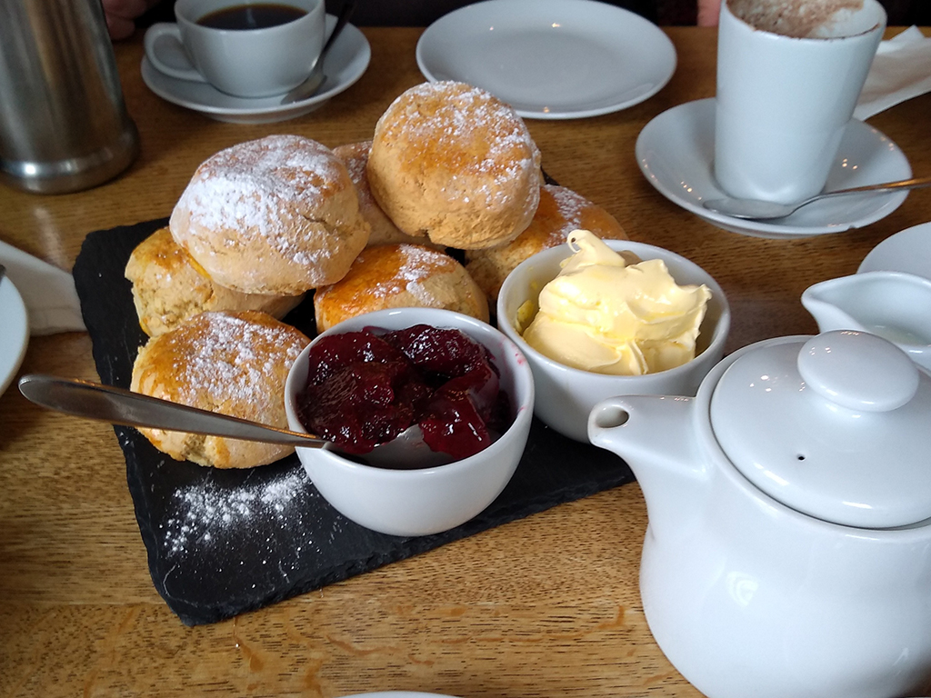
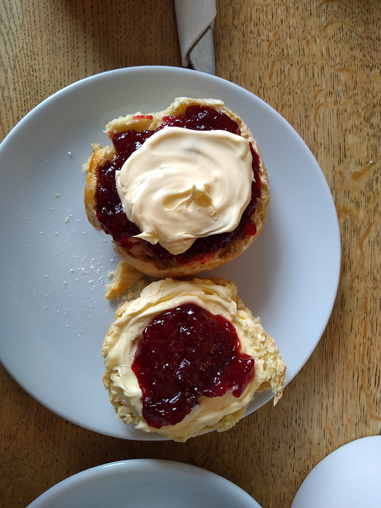
Tea, as you may not know, is actually a light meal in Britain, not just a hot beverage. A Cream Tea is tea served with scones, clotted cream, and jam. We had heard a lot about this from Ruth and Darren, but unwittingly stumbled into a long running feud between Devon and Cornwall.
I’m hungry again just looking at it. My wife took this and the next photo.
According to those from Devon, the “proper” way to have Cream Tea is to split the scone in two, spread the cream first and then put the jam on top. The Cornish way is to put the jam on first and then spoon the cream on top. Ruth is a proponent of the Devonshire method while Darren prefers the Cornish method.
Whether the Devonshire way (bottom) or the Cornish way (top), our Cream Tea was fabulous.
There was much good-natured jibing, and I have to say I preferred the Cornish way (you get more of the cream taste that way), but no matter how you take it, this was a real highlight of the trip for me. Plus, my hot chocolate (in lieu of the tea and its caffeine) was amazing as well.
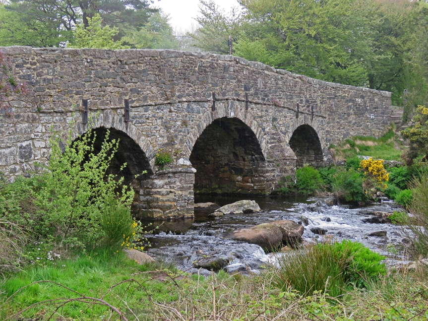
With full bellies we made our way back out and drove further into Dartmoor, making a stop at picturesque Postbridge and its medieval clapper bridge. Clapper bridges are simple slabs of rock placed across a river to cross it. In this case, two piers of stone were placed as supports.
The East Dart River flowing beneath the clapper bridge. Photo taken by my wife.
The adjacent roadway bridge was beautiful as well.
The roadway bridge over the East Dart River.
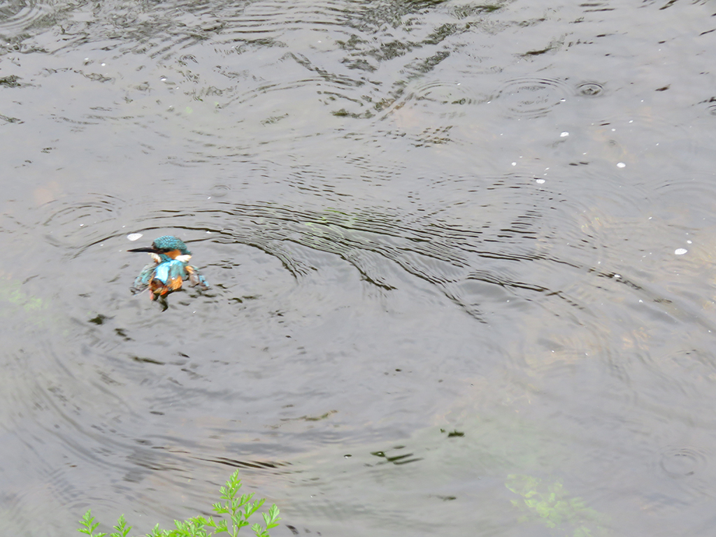
While we were admiring the view (and I was passively birdwatching), I noticed some commotion. A woman had been trying to rescue a Common Kingfisher and it had tried to get out of the cardboard box it was in and had fallen into the cold water below.
This Common Kingfisher was in distress. I though maybe it was a fledgling given the relative shortness of its bill, but I don’t know the species well enough.
A traveler who was hiking his way along the river immediately waded in and scooped up the bird, which was now shivering with cold, and the woman asked if we knew anyone who could help. I suggested any local wildlife rehabilitators, and she said she had tried and had no luck. Her intention was to dry and warm up the bird and give it time to recover and then release it. We wished her luck and thanked the man, who went on his way, wet and cold himself.
There were other interesting birds by the river as well, including a White-throated Dipper, gathering invertebrates of some kind, likely to feed its young. Dippers are fun little birds. They are adept at running along the bottom of fast moving streams, often completely submerged in pursuit of prey. They can also dive and swim quite well.
A dipper foraging beneath the clapper bridge. You can just see the long grappling claws it uses to keep anchored to rocks, especially under water.
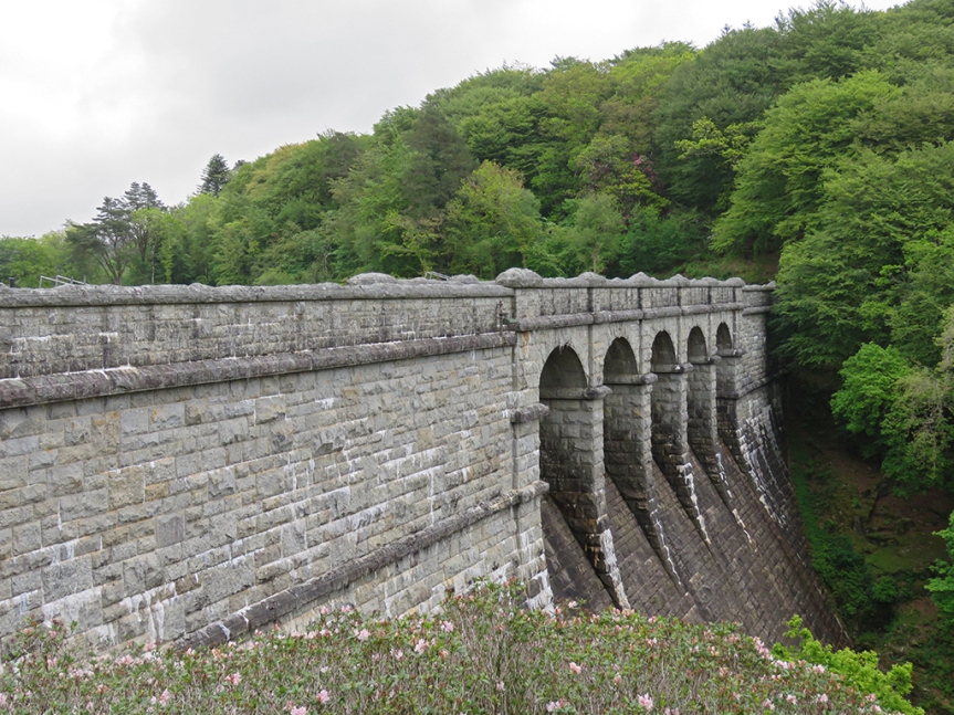
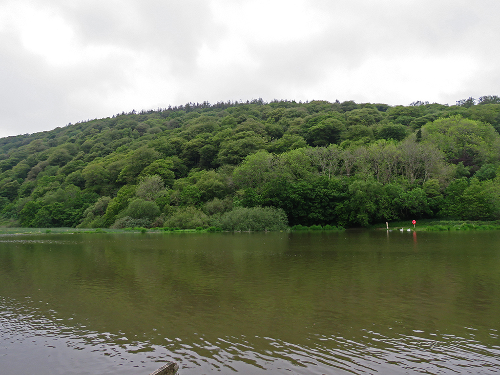
Another short drive brought us to Burrator Reservoir on the River Tavy and a nearby nature trail. Burrator provides some of the drinking water for Plymouth and surrounding places.
The area right around the dam is wooded with a tight canopy.
It was quiet around the reservoir with not much traffic and the weather was calm, and the sun had peeked out every now and then.
We made our way along a trail after passing a small but beautiful waterfall and cascading stream. The sound backdrop was serene and almost idyllic.
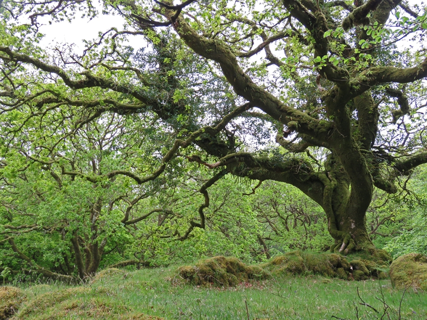
The vegetation here seemed well suited to damp weather, with many of the older trees covered in moss.
And old and gnarled tree, covered in moss.
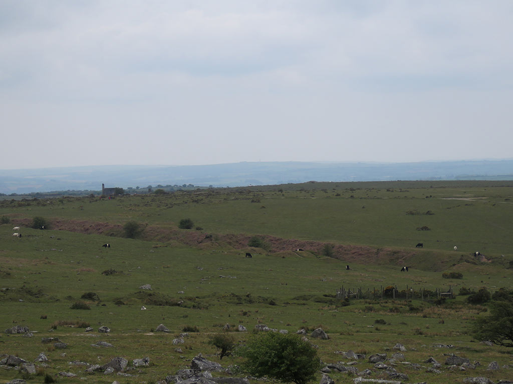
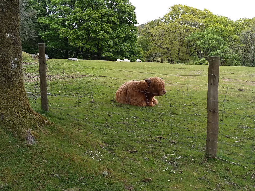
As we walked the ground gently rose as we make our way up onto the moor. Even here, there were cows grazing and resting in fenced off fields. In Britain, the concept of conservation is a bit different than here in the States. Here, the usual focus of environmental conservation revolves around preservation or the return of the landscape to some idealized natural state. In Britain, the majority of conservation efforts involve preservation of rural landscapes, such as farms, villages, and grazing lands.
This shaggy-haired bovine had a very 60s mop-top vibe about it.
All the while we were walking up the path, birds were singing and darting in and out of the trees. This included Willow Tits (differentiated by their song), Coal Tits, and quite a few songs I could not identify.
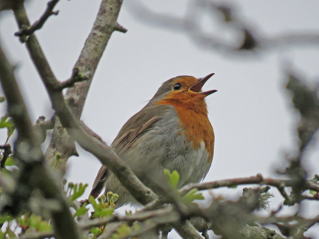
The ever ubiquitous robins were singing in full force. These birds must be among the most adaptable in the world.
We didn’t walk much farther and turned back down the trail to the car park (that’s a parking lot, fellow Americans) and headed to our last stop of the day, at Lopwell Ford, on the River Tavy.
The River Tavy was still on the rise from recent days of rain. You can see the far side of the ford to the left of the red marker on the far shore.
The water level was fairly high, and we could see it rise on the level indicator signs in the river. When the water is lower, vehicles can cross (ford) the river and get to the other side. Suffice it to say, without a taller vehicle like a truck or SUV with a snorkel, we weren’t managing that! But is was a pretty stop.
Mrs. Lonely Birder enjoying the early evening by Lopwell Ford and its nearby buildings.
With that, it was back to Bristol to plan our next days’ excursions. Dartmoor is an amazing place, and I can imagine spending two weeks just exploring that area alone. But for us, it was on to the next!
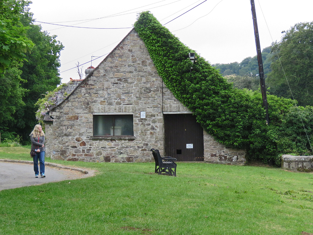
After spending most of our first week around Bristol and Somerset, we started our second week by heading southwest to the county of Devon and spent the day around Dartmoor National Park [map].
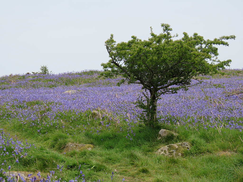
Dartmoor is an upland area covered in low vegetation and bogs, with granite outcrops (called tors) and very few trees. Large areas are covered in English Bluebells, which even in the intermittent morning overcast were beautiful. Ruth told us that the flowers were past their peak, but the vivid purple was still quite a sight.
English Bluebells cover large sections of the moorland.
There are few trees on the moor. The large, ancient forests that covered this land were slowly cleared over the centuries. Human activities, like grazing and farming changed the soil, making it acidic, further converting the land. A few trees do grow, and there are small sections of forest remaining, and there are restoration efforts under way in part of the park.
Scrubby trees like this are scattered around on the moor. In a couple of denser copses, I heard European Cuckoos!
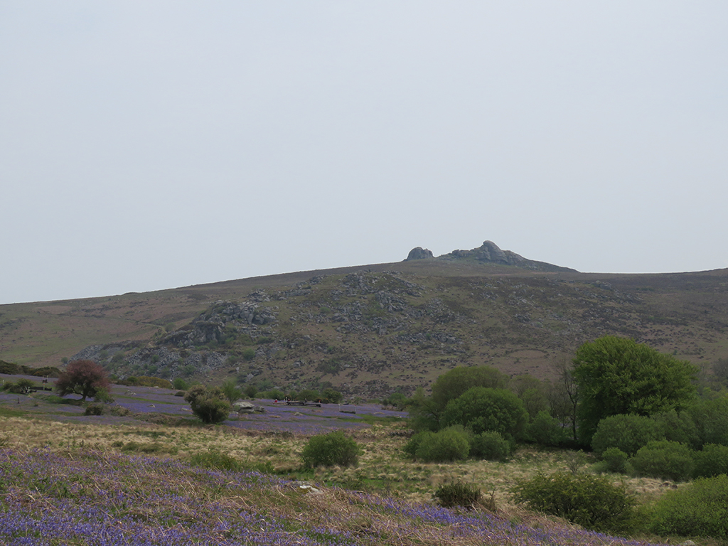
Dartmoor has hundreds of tors. These prominent high points, some topped with granite knobs or spires, are important landmarks and many can be seen for miles away (by the way, you may have noticed I’ve been using miles and feet in these UK posts. As metric as Britain is, roads and distances are more often still in “imperial” units).
One of many tors in the landscape. There are so many that a few have redundant names!
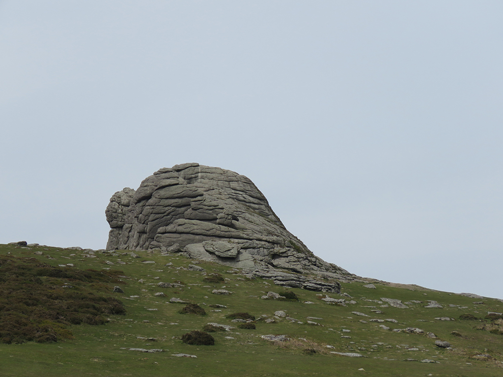
Much like the Cheesewring (which we’ll see in a future post), these outcrops are completely natural. The shapes and apparent layers are due to persistent wind and water erosion over the course of many millennia.
Some of the rocks in the foreground are simply granite that’s been exposed from just below the surface. Some of the larger ones resting on the grass have tumbled from the tor itself as the inexorable forces of erosion do their job.
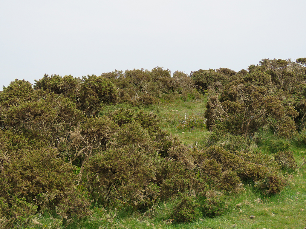
For large parts of the moorland gorse and bogs dominate the landscape. Here is a patch of gorse without the iconic yellow flowers. This thick cover is ideal for protecting various bird species which nest or roost within. I saw Meadow Pipits, Eurasian Stonechats, and even a couple of skylarks.
Gorse, near some bird nesting habitat signs. I didn’t walk too far in – this stuff is thick and has a lot of thorns!
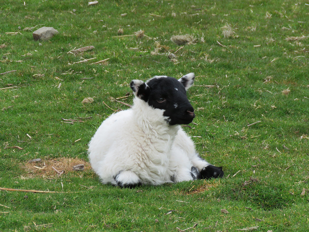
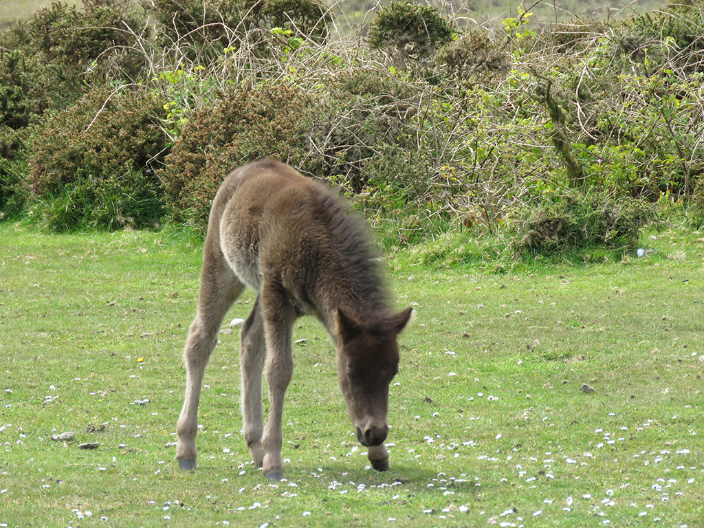
Dartmoor is famous for it’s wild ponies. They can seem quite tame and will walk up to visitors and even touch you with their noses or flanks. But they are wild and should be treated with that level of respect. Many of the mares had foals.
A baby pony sleeping while Mom rests nearby.
As we wandered around near one parking area, one pony walked up to my wife and did in fact touch its nose to her hand. The mares were relatively unconcerned with our proximity to their offspring.
There were quite a few very young ponies around the moor. This one was still a little shaky on its feet.
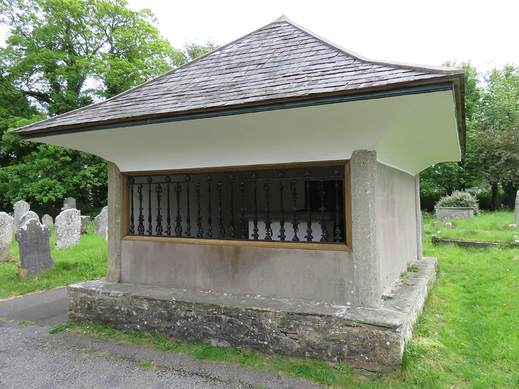
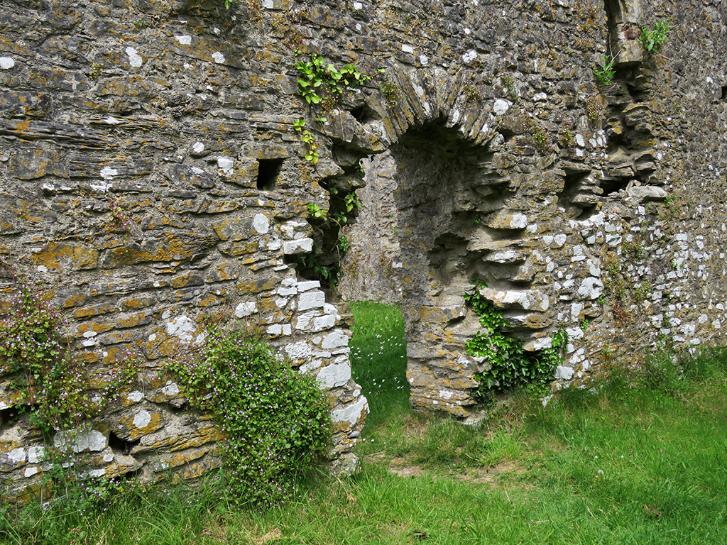
We drove to a few more vantage points around the park, including looks at the prison (“HM Prison Dartmoor”) and more tors. From there we made our way past Buckfastleigh and to the ruins of Holy Trinity Church [map]. On the adjacent cemetery grounds is the mausoleum of Richard Cabell, on whose legend and death Sir Arthur Conan Doyle based “The Hound of the Baskervilles”.
Cabell was said to be an extremely angry and mean person, and would set his large dogs upon trespassers on his land. When he died, he was placed in a relatively unadorned mausoleum, beneath a heavy stone surrounded by iron bars, to “…prevent his coming up and haunting the neighbourhood,” according to an early 20th Century travel guide to Dartmoor.
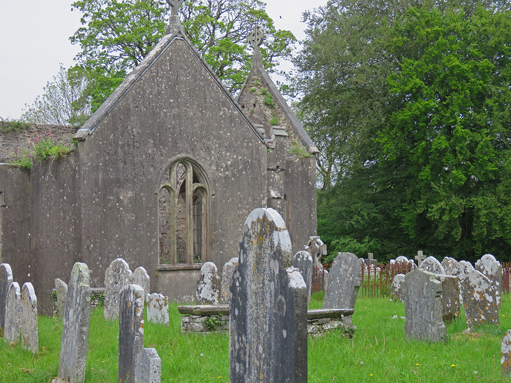
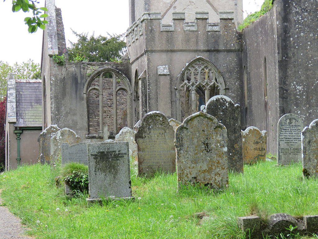
The church itself is in ruins now, victim of vandals and arson in the 1990s. The elements have deteriorated the structure and the headstones more quickly than one might expect. This, combined with lichens and mosses growing on the stone makes the churchyard look even older still.
The church, cemetery, and Sir Richard’s mausoleum are popular tourist attractions, and we saw a couple of tour groups and photographers making their way around the grounds.
We left Master Cabell and his company of headstones and started for home, though we’d visit Dartmoor a couple more times during our stay in the UK. You’ll have to stay tuned for those upcoming posts!
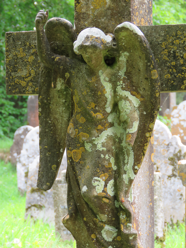
Don’t blink. This Weeping Angel might be deteriorating, but you mustn’t let your guard down!